

xdxdxd
- 42.5 km
- 665 m
- 705 m
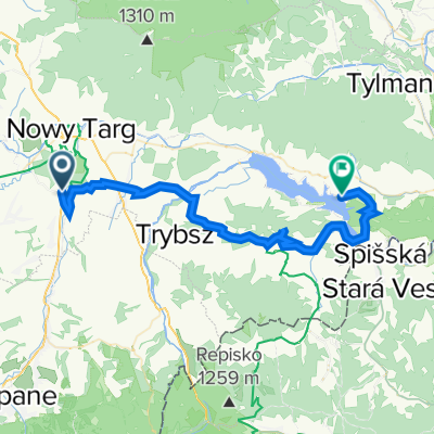
- Szaflary, Lesser Poland Voivodeship, Poland
A cycling route starting in Szaflary, Lesser Poland Voivodeship, Poland.
Overview
The proposed cycling route was prepared by the Association for the Development of the Szaflary Municipality.
created this 11 years ago
Route quality
Road
9.2 km
(69 %)
Quiet road
4 km
(30 %)
Undefined
0.1 km
(1 %)
Paved
9.6 km
(72 %)
Asphalt
9.6 km
(72 %)
Undefined
3.7 km
(28 %)
Continue with Bikemap
You would like to ride B - Szaflary-Bór-Gronków-Leśnica or customize it for your own trip? Here is what you can do with this Bikemap route:
Free trial for 3 days, or one-time payment. More about Bikemap Premium.
Discover more Premium features.
Get Bikemap PremiumFrom our community
Open it in the app


