- 41.9 km
- 93 m
- 328 m
- Pasadena, California, United States
Performance Bike Advanced ride 13 December
A cycling route starting in Pasadena, California, United States.
Overview
About this route
Up to Mount Wilson and back, although there are a couple of turn around spots if needed. There will be regrouping given the inclination and curation of the climb.
- -:--
- Duration
- 88.7 km
- Distance
- 1,708 m
- Ascent
- 1,720 m
- Descent
- ---
- Avg. speed
- ---
- Max. altitude
created this 11 years ago
Route quality
Waytypes & surfaces along the route
Waytypes
Road
23.1 km
(26 %)
Quiet road
13.3 km
(15 %)
Surfaces
Paved
60.3 km
(68 %)
Asphalt
53.2 km
(60 %)
Paved (undefined)
7.1 km
(8 %)
Undefined
28.4 km
(32 %)
Route highlights
Points of interest along the route
Point of interest after 20.7 km
Regroup
Point of interest after 26.1 km
regroup
Point of interest after 31.3 km
Regroup and water (free!). Possibility of turning around here depending upon time and energy needs.
Point of interest after 38.9 km
Regroup possible turn around depending on time and energy
Point of interest after 55 km
Regroup
Continue with Bikemap
Use, edit, or download this cycling route
You would like to ride Performance Bike Advanced ride 13 December or customize it for your own trip? Here is what you can do with this Bikemap route:
Free features
- Save this route as favorite or in collections
- Copy & plan your own version of this route
- Split it into stages to create a multi-day tour
- Sync your route with Garmin or Wahoo
Premium features
Free trial for 3 days, or one-time payment. More about Bikemap Premium.
- Navigate this route on iOS & Android
- Export a GPX / KML file of this route
- Create your custom printout (try it for free)
- Download this route for offline navigation
Discover more Premium features.
Get Bikemap PremiumFrom our community
Other popular routes starting in Pasadena
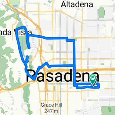
- E Green St, Pasadena to Duncan Ave, Lynwood
- Rose Bowl, Arroyo Seco, South Pas back El Molino
- 21.5 km
- 135 m
- 133 m
- Pasadena, California, United States
- North Los Robles Avenue to North Avenue
- 9.2 km
- 75 m
- 177 m
- Pasadena, California, United States
- N Marengo Ave, Pasadena to Sunset Ridge Trail, Altadena
- 14.7 km
- 621 m
- 88 m
- Pasadena, California, United States
- Cracking ride in Pasadena
- 20.4 km
- 201 m
- 200 m
- Pasadena, California, United States
- Local & Flat
- 53.7 km
- 514 m
- 508 m
- Pasadena, California, United States
- Arroyo Seco to Marengo Ave
- 15.9 km
- 167 m
- 170 m
- Pasadena, California, United States
- Century Ride
- 55.2 km
- 685 m
- 681 m
- Pasadena, California, United States
Open it in the app


