

FENER - BIGOLINO (Lungo il Piave )
A cycling route starting in Segusino, Veneto, Italy.
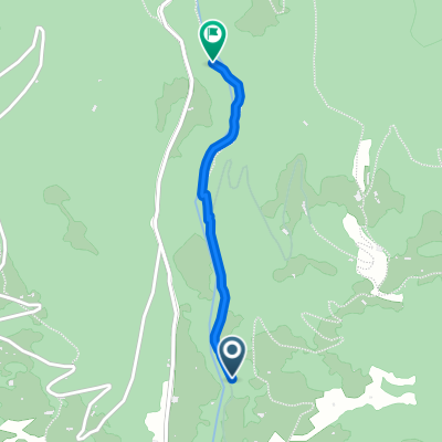
Overview
About this route
TECHNICAL FEATURES
Length: 12.0 km
Time required: 1 hour
General characteristics: very varied stretch with different sceneries, from climbs to descents to the recovery of historical places.
Recommended seasons: better dry seasons for the rugged sections near the Piave in Bigolino.
- -:--
- Duration
- 10.1 km
- Distance
- 90 m
- Ascent
- 100 m
- Descent
- ---
- Avg. speed
- ---
- Max. altitude

Route highlights
Points of interest along the route
Point of interest after 0.2 km
CENTRO
Point of interest after 0.4 km
STAZIONE
Point of interest after 1.4 km
PIAVE
Point of interest after 5.4 km
CAPITELLO
Point of interest after 7.7 km
PARCO
Point of interest after 9.2 km
CAPITELLO
Point of interest after 10.1 km
PIAZZA
Point of interest after 10.1 km
CHIESA BIGOLINO
Continue with Bikemap
Use, edit, or download this cycling route
You would like to ride FENER - BIGOLINO (Lungo il Piave ) or customize it for your own trip? Here is what you can do with this Bikemap route:
Free features
- Save this route as favorite or in collections
- Copy & plan your own version of this route
- Sync your route with Garmin or Wahoo
Premium features
Free trial for 3 days, or one-time payment. More about Bikemap Premium.
- Navigate this route on iOS & Android
- Export a GPX / KML file of this route
- Create your custom printout (try it for free)
- Download this route for offline navigation
Discover more Premium features.
Get Bikemap PremiumFrom our community
Other popular routes starting in Segusino
 grappa
- Distance
- 72.7 km
- Ascent
- 1,650 m
- Descent
- 1,575 m
- Location
- Segusino, Veneto, Italy
 Da Via Cal del Pont a Via San Valentino 30-34
- Distance
- 1.2 km
- Ascent
- 136 m
- Descent
- 76 m
- Location
- Segusino, Veneto, Italy
 Segusino Pianezze Milies enduro
- Distance
- 29 km
- Ascent
- 1,183 m
- Descent
- 1,173 m
- Location
- Segusino, Veneto, Italy
 Monte Grappa
- Distance
- 82.5 km
- Ascent
- 1,735 m
- Descent
- 1,735 m
- Location
- Segusino, Veneto, Italy
 Milies
- Distance
- 30.3 km
- Ascent
- 1,042 m
- Descent
- 1,042 m
- Location
- Segusino, Veneto, Italy
 monte grappa
- Distance
- 97.5 km
- Ascent
- 3,074 m
- Descent
- 3,075 m
- Location
- Segusino, Veneto, Italy
 variante sx piave fener ponte di piave
- Distance
- 58.2 km
- Ascent
- 96 m
- Descent
- 278 m
- Location
- Segusino, Veneto, Italy
 m.Grappa da alano di piave
- Distance
- 78.5 km
- Ascent
- 1,720 m
- Descent
- 1,720 m
- Location
- Segusino, Veneto, Italy
Open it in the app