
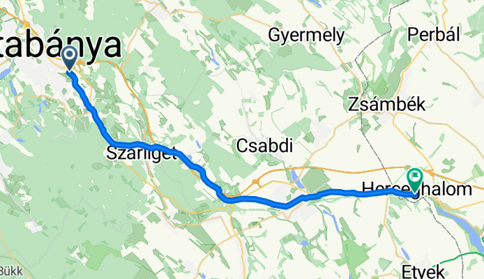
Tatabánya-Herceghalom
A cycling route starting in Tatabánya, Komárom-Esztergom, Hungary.
Overview
About this route
To Bicske via secondary roads, between Bicske and Herceghalom on the old Vienna road, parallel to main road 1.
- -:--
- Duration
- 29 km
- Distance
- 242 m
- Ascent
- 263 m
- Descent
- ---
- Avg. speed
- ---
- Max. altitude

Route quality
Waytypes & surfaces along the route
Waytypes
Quiet road
6.4 km
(22 %)
Road
1.2 km
(4 %)
Surfaces
Paved
26.7 km
(92 %)
Asphalt
26.7 km
(92 %)
Undefined
2.3 km
(8 %)
Continue with Bikemap
Use, edit, or download this cycling route
You would like to ride Tatabánya-Herceghalom or customize it for your own trip? Here is what you can do with this Bikemap route:
Free features
- Save this route as favorite or in collections
- Copy & plan your own version of this route
- Sync your route with Garmin or Wahoo
Premium features
Free trial for 3 days, or one-time payment. More about Bikemap Premium.
- Navigate this route on iOS & Android
- Export a GPX / KML file of this route
- Create your custom printout (try it for free)
- Download this route for offline navigation
Discover more Premium features.
Get Bikemap PremiumFrom our community
Other popular routes starting in Tatabánya
 Útvonal
- Distance
- 37.6 km
- Ascent
- 123 m
- Descent
- 123 m
- Location
- Tatabánya, Komárom-Esztergom, Hungary
 Tatabánya-Tata félmaraton
- Distance
- 21.5 km
- Ascent
- 25 m
- Descent
- 27 m
- Location
- Tatabánya, Komárom-Esztergom, Hungary
 From Tatabánya to Oroszlány
- Distance
- 16.5 km
- Ascent
- 55 m
- Descent
- 11 m
- Location
- Tatabánya, Komárom-Esztergom, Hungary
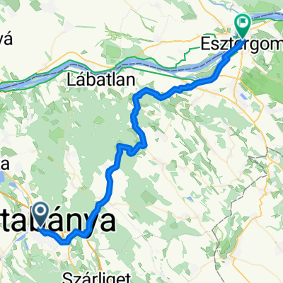 Tatabánya-Esztergom
- Distance
- 51.7 km
- Ascent
- 410 m
- Descent
- 446 m
- Location
- Tatabánya, Komárom-Esztergom, Hungary
 Imported route
- Distance
- 25.8 km
- Ascent
- 70 m
- Descent
- 78 m
- Location
- Tatabánya, Komárom-Esztergom, Hungary
 Tatabánya-ÁltalérBicóút
- Distance
- 19.6 km
- Ascent
- 23 m
- Descent
- 51 m
- Location
- Tatabánya, Komárom-Esztergom, Hungary
 Tatabánya - Majk (Oroszlány) a kerékpárúton
- Distance
- 11.2 km
- Ascent
- 67 m
- Descent
- 24 m
- Location
- Tatabánya, Komárom-Esztergom, Hungary
 Óláb-Vértestolna-Óláb
- Distance
- 16.3 km
- Ascent
- 244 m
- Descent
- 248 m
- Location
- Tatabánya, Komárom-Esztergom, Hungary
Open it in the app