

Lauingen Albtrauf erleben
A cycling route starting in Dischingen, Baden-Wurttemberg, Germany.
Overview
About this route
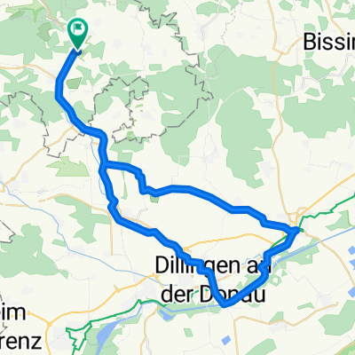
von der Donauebene bei Lauingen hinauf zum Albtrauf auf dem Härtsfeld. Auch beschrieben im Rad-Flyer des Landkreises Dillingen.
- -:--
- Duration
- 51.8 km
- Distance
- 340 m
- Ascent
- 336 m
- Descent
- ---
- Avg. speed
- ---
- Max. altitude

Continue with Bikemap
Use, edit, or download this cycling route
You would like to ride Lauingen Albtrauf erleben or customize it for your own trip? Here is what you can do with this Bikemap route:
Free features
- Save this route as favorite or in collections
- Copy & plan your own version of this route
- Sync your route with Garmin or Wahoo
Premium features
Free trial for 3 days, or one-time payment. More about Bikemap Premium.
- Navigate this route on iOS & Android
- Export a GPX / KML file of this route
- Create your custom printout (try it for free)
- Download this route for offline navigation
Discover more Premium features.
Get Bikemap PremiumFrom our community
Other popular routes starting in Dischingen
 Dischingen - Regensburg
- Distance
- 234.2 km
- Ascent
- 502 m
- Descent
- 637 m
- Location
- Dischingen, Baden-Wurttemberg, Germany
 Dischingen-Nördlingen-Wemding Tag 2
- Distance
- 56 km
- Ascent
- 398 m
- Descent
- 403 m
- Location
- Dischingen, Baden-Wurttemberg, Germany
 Dischingen - Donauwörth
- Distance
- 53.5 km
- Ascent
- 157 m
- Descent
- 138 m
- Location
- Dischingen, Baden-Wurttemberg, Germany
 Route über Christgarten
- Distance
- 32.5 km
- Ascent
- 359 m
- Descent
- 368 m
- Location
- Dischingen, Baden-Wurttemberg, Germany
 Dischingen - Finningen
- Distance
- 56.8 km
- Ascent
- 464 m
- Descent
- 463 m
- Location
- Dischingen, Baden-Wurttemberg, Germany
 Härtsfeldsee Donau
- Distance
- 55.8 km
- Ascent
- 127 m
- Descent
- 127 m
- Location
- Dischingen, Baden-Wurttemberg, Germany
 Lauingen Albtrauf erleben
- Distance
- 51.8 km
- Ascent
- 340 m
- Descent
- 336 m
- Location
- Dischingen, Baden-Wurttemberg, Germany
 Radausfahrt 2014 - Schwäbische Alb Umrundung
- Distance
- 633.7 km
- Ascent
- 2,075 m
- Descent
- 2,075 m
- Location
- Dischingen, Baden-Wurttemberg, Germany
Open it in the app