

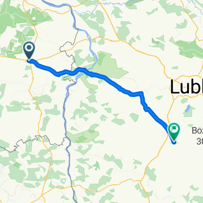
GRANICZNA 51 TRASA2
A cycling route starting in Zwoleń, Masovian Voivodeship, Poland.
Overview
About this route
Some sections have weak asphalt, but they are short stretches.
- -:--
- Duration
- 186.7 km
- Distance
- 216 m
- Ascent
- 216 m
- Descent
- ---
- Avg. speed
- ---
- Max. altitude
Continue with Bikemap
Use, edit, or download this cycling route
You would like to ride GRANICZNA 51 TRASA2 or customize it for your own trip? Here is what you can do with this Bikemap route:
Free features
- Save this route as favorite or in collections
- Copy & plan your own version of this route
- Split it into stages to create a multi-day tour
- Sync your route with Garmin or Wahoo
Premium features
Free trial for 3 days, or one-time payment. More about Bikemap Premium.
- Navigate this route on iOS & Android
- Export a GPX / KML file of this route
- Create your custom printout (try it for free)
- Download this route for offline navigation
Discover more Premium features.
Get Bikemap PremiumFrom our community
Other popular routes starting in Zwoleń
 From Zwoleń to Stalowa Wola
- Distance
- 111.6 km
- Ascent
- 422 m
- Descent
- 424 m
- Location
- Zwoleń, Masovian Voivodeship, Poland
 Zwoleń- Iłża
- Distance
- 37.8 km
- Ascent
- 80 m
- Descent
- 51 m
- Location
- Zwoleń, Masovian Voivodeship, Poland
 Szlakiem Kochanowskich
- Distance
- 66.7 km
- Ascent
- 130 m
- Descent
- 130 m
- Location
- Zwoleń, Masovian Voivodeship, Poland
 Zwoleń- Strzyżewice
- Distance
- 80.7 km
- Ascent
- 272 m
- Descent
- 237 m
- Location
- Zwoleń, Masovian Voivodeship, Poland
 Wola Goryńsk, bunkry
- Distance
- 43.3 km
- Ascent
- 100 m
- Descent
- 114 m
- Location
- Zwoleń, Masovian Voivodeship, Poland
 5. E. Zwolen - Berdyszcze 174 km, 500 Hm
- Distance
- 174.6 km
- Ascent
- 0 m
- Descent
- 0 m
- Location
- Zwoleń, Masovian Voivodeship, Poland
 VII Pielgrzymka II etap
- Distance
- 104.6 km
- Ascent
- 250 m
- Descent
- 267 m
- Location
- Zwoleń, Masovian Voivodeship, Poland
 GRANICZNA 51 TRASA2
- Distance
- 186.7 km
- Ascent
- 216 m
- Descent
- 216 m
- Location
- Zwoleń, Masovian Voivodeship, Poland
Open it in the app