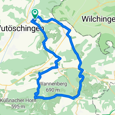
Rheintal, Wehratal, Hotzenwald
A cycling route starting in Wutöschingen, Baden-Wurttemberg, Germany.
Overview
About this route
The route on the Swiss side mainly follows bike paths or bike lanes along the Rhine to Bad Säckingen. Then it goes on secondary roads to Wehr and then through the beautiful Wehratal valley to Todtmoos. Over the Black Forest, it returns to Wutöschingen. Since it is a circular route, the tour can be started at any point. Caution on weekends for reckless motorcyclists, especially in the Wehratal.
- -:--
- Duration
- 125.4 km
- Distance
- 1,026 m
- Ascent
- 1,029 m
- Descent
- ---
- Avg. speed
- ---
- Max. altitude
Route quality
Waytypes & surfaces along the route
Waytypes
Quiet road
20.1 km
(16 %)
Track
17.6 km
(14 %)
Surfaces
Paved
89 km
(71 %)
Unpaved
8.8 km
(7 %)
Asphalt
87.8 km
(70 %)
Gravel
7.5 km
(6 %)
Continue with Bikemap
Use, edit, or download this cycling route
You would like to ride Rheintal, Wehratal, Hotzenwald or customize it for your own trip? Here is what you can do with this Bikemap route:
Free features
- Save this route as favorite or in collections
- Copy & plan your own version of this route
- Split it into stages to create a multi-day tour
- Sync your route with Garmin or Wahoo
Premium features
Free trial for 3 days, or one-time payment. More about Bikemap Premium.
- Navigate this route on iOS & Android
- Export a GPX / KML file of this route
- Create your custom printout (try it for free)
- Download this route for offline navigation
Discover more Premium features.
Get Bikemap PremiumFrom our community
Other popular routes starting in Wutöschingen
- Degernau - Faudiwegtrail
- Distance
- 35.6 km
- Ascent
- 637 m
- Descent
- 637 m
- Location
- Wutöschingen, Baden-Wurttemberg, Germany
- Wutöschingen-Bergöschingen-Küssaburg
- Distance
- 28.8 km
- Ascent
- 615 m
- Descent
- 615 m
- Location
- Wutöschingen, Baden-Wurttemberg, Germany
- Klettgau, Zürcher Weinland
- Distance
- 98.8 km
- Ascent
- 410 m
- Descent
- 411 m
- Location
- Wutöschingen, Baden-Wurttemberg, Germany
- Côte Krenkingen, 656m
- Distance
- 4.1 km
- Ascent
- 257 m
- Descent
- 0 m
- Location
- Wutöschingen, Baden-Wurttemberg, Germany
- Über die Höhen des Wutachtals
- Distance
- 33.4 km
- Ascent
- 409 m
- Descent
- 411 m
- Location
- Wutöschingen, Baden-Wurttemberg, Germany
- Rheintal, Wehratal, Hotzenwald
- Distance
- 125.4 km
- Ascent
- 1,026 m
- Descent
- 1,029 m
- Location
- Wutöschingen, Baden-Wurttemberg, Germany
- Klettgau, Furka
- Distance
- 177.5 km
- Ascent
- 1,820 m
- Descent
- 676 m
- Location
- Wutöschingen, Baden-Wurttemberg, Germany
- Degernau - Wannenberg
- Distance
- 27.7 km
- Ascent
- 700 m
- Descent
- 700 m
- Location
- Wutöschingen, Baden-Wurttemberg, Germany
Open it in the app