Wrocław > Oleśnica > SZCZODRE > Wrocław
A cycling route starting in Wilczyce, Lower Silesian Voivodeship, Poland.
Overview
About this route
27.12.2014
- -:--
- Duration
- 65.6 km
- Distance
- 95 m
- Ascent
- 93 m
- Descent
- ---
- Avg. speed
- ---
- Max. altitude
Route quality
Waytypes & surfaces along the route
Waytypes
Road
26.9 km
(41 %)
Track
14.4 km
(22 %)
Surfaces
Paved
43.3 km
(66 %)
Unpaved
14.4 km
(22 %)
Asphalt
41.3 km
(63 %)
Gravel
5.9 km
(9 %)
Route highlights
Points of interest along the route

Point of interest after 0 km
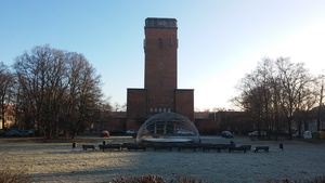
Kościół Pamiątkowy Króla Gustawa Adolfa

Point of interest after 2.3 km
Most Bartoszowicki

Point of interest after 2.6 km
Śluza Bartoszowicka

Point of interest after 3.4 km
Śluza Łaniewska

Point of interest after 3.4 km
widok w kierunku "schronu piechoty"

Point of interest after 13 km
Widawa

Point of interest after 14 km
Oleśnica

Point of interest after 18.4 km
Kątna

Point of interest after 30.9 km
mury miejskie Oleśnicy

Point of interest after 31.2 km
Cerkiew Zaśnięcia NMP

Point of interest after 31.4 km
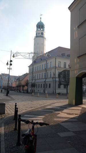
ratusz w Oleśnicy

Point of interest after 31.6 km
Brama Wrocławska

Point of interest after 31.7 km
Bazylika Mniejsza pw. Św. Jana

Point of interest after 32 km
Zamek Książąt Oleśnickich

Point of interest after 38.1 km

Point of interest after 40.6 km
Stępin, kościół

Point of interest after 49.3 km
Pałac Sybilli, budynek teatru

Point of interest after 49.5 km
Pałac Sybilli w Szczodrem, kiedyś jeden z największych w Europie

Point of interest after 60.2 km
most na Widawie

Point of interest after 62.8 km
schron piechoty

Point of interest after 64.7 km
Continue with Bikemap
Use, edit, or download this cycling route
You would like to ride Wrocław > Oleśnica > SZCZODRE > Wrocław or customize it for your own trip? Here is what you can do with this Bikemap route:
Free features
- Save this route as favorite or in collections
- Copy & plan your own version of this route
- Sync your route with Garmin or Wahoo
Premium features
Free trial for 3 days, or one-time payment. More about Bikemap Premium.
- Navigate this route on iOS & Android
- Export a GPX / KML file of this route
- Create your custom printout (try it for free)
- Download this route for offline navigation
Discover more Premium features.
Get Bikemap PremiumFrom our community
Other popular routes starting in Wilczyce
 Wrocław - 20 km i wiele ciekawych miejsc
- Distance
- 20 km
- Ascent
- 27 m
- Descent
- 30 m
- Location
- Wilczyce, Lower Silesian Voivodeship, Poland
 Kamieniec Wrocławski (przez: Wojnów, Bajkał, Psie Pole)
- Distance
- 36.5 km
- Ascent
- 42 m
- Descent
- 40 m
- Location
- Wilczyce, Lower Silesian Voivodeship, Poland
 Widawa i Odra
- Distance
- 54.1 km
- Ascent
- 68 m
- Descent
- 70 m
- Location
- Wilczyce, Lower Silesian Voivodeship, Poland
 W. Sowa
- Distance
- 182.6 km
- Ascent
- 937 m
- Descent
- 937 m
- Location
- Wilczyce, Lower Silesian Voivodeship, Poland
 W dolinę Bystrzycy
- Distance
- 81.4 km
- Ascent
- 49 m
- Descent
- 51 m
- Location
- Wilczyce, Lower Silesian Voivodeship, Poland
 Long ride through Długołęka
- Distance
- 30.5 km
- Ascent
- 17 m
- Descent
- 19 m
- Location
- Wilczyce, Lower Silesian Voivodeship, Poland
 Z Wrocławia w góry Dolnego Śląska / From Wroclaw into Lower Silesian mountains
- Distance
- 511.5 km
- Ascent
- 3,894 m
- Descent
- 3,476 m
- Location
- Wilczyce, Lower Silesian Voivodeship, Poland
 Pasikurowice (przez: Las Zakrzowski)
- Distance
- 22.4 km
- Ascent
- 40 m
- Descent
- 41 m
- Location
- Wilczyce, Lower Silesian Voivodeship, Poland
Open it in the app


