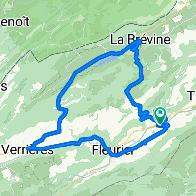
Val de Travers / Tailleres round trip
A cycling route starting in Couvet, Canton of Neuchâtel, Switzerland.
Overview
About this route
Attracive round trip
Bus from Couvet to La Brevin can avoid tough climb Eat at lake restaurant like boat or Petit Cerni (sauna available) <div style="left: -1000px; top: 37.79px; width: 1px; height: 1px; overflow: hidden; position: absolute;"> </div> <div style="left: -1000px; top: 37.79px; width: 1px; height: 1px; overflow: hidden; position: absolute;"> </div>
- -:--
- Duration
- 47.6 km
- Distance
- 591 m
- Ascent
- 588 m
- Descent
- ---
- Avg. speed
- ---
- Max. altitude
Route quality
Waytypes & surfaces along the route
Waytypes
Road
15.7 km
(33 %)
Quiet road
15.2 km
(32 %)
Surfaces
Paved
4.3 km
(9 %)
Unpaved
0.5 km
(1 %)
Asphalt
3.3 km
(7 %)
Paved (undefined)
1 km
(2 %)
Continue with Bikemap
Use, edit, or download this cycling route
You would like to ride Val de Travers / Tailleres round trip or customize it for your own trip? Here is what you can do with this Bikemap route:
Free features
- Save this route as favorite or in collections
- Copy & plan your own version of this route
- Sync your route with Garmin or Wahoo
Premium features
Free trial for 3 days, or one-time payment. More about Bikemap Premium.
- Navigate this route on iOS & Android
- Export a GPX / KML file of this route
- Create your custom printout (try it for free)
- Download this route for offline navigation
Discover more Premium features.
Get Bikemap PremiumFrom our community
Other popular routes starting in Couvet
- 8. Etappe_Tour de Suisse
- Distance
- 108.3 km
- Ascent
- 1,350 m
- Descent
- 1,715 m
- Location
- Couvet, Canton of Neuchâtel, Switzerland
- Nouvelle Censière circuit / Vallon de Noirvaux
- Distance
- 44.2 km
- Ascent
- 683 m
- Descent
- 683 m
- Location
- Couvet, Canton of Neuchâtel, Switzerland
- Gorge de L'Areuse - Beau Rivage (Neuchatel)
- Distance
- 33 km
- Ascent
- 112 m
- Descent
- 420 m
- Location
- Couvet, Canton of Neuchâtel, Switzerland
- Val de Travers / Tailleres round trip
- Distance
- 47.6 km
- Ascent
- 591 m
- Descent
- 588 m
- Location
- Couvet, Canton of Neuchâtel, Switzerland
- Jura Tour: Couvet -> Saignlegier
- Distance
- 70.4 km
- Ascent
- 885 m
- Descent
- 639 m
- Location
- Couvet, Canton of Neuchâtel, Switzerland
- Val de Travers / Vallon de Noirvaux
- Distance
- 38.4 km
- Ascent
- 431 m
- Descent
- 429 m
- Location
- Couvet, Canton of Neuchâtel, Switzerland
- Les Taillères, Montlebon, Nid du Fol, Rundfahrt
- Distance
- 39.7 km
- Ascent
- 681 m
- Descent
- 679 m
- Location
- Couvet, Canton of Neuchâtel, Switzerland
- Jura Tour: Couvet - Bellelay
- Distance
- 80.2 km
- Ascent
- 1,012 m
- Descent
- 792 m
- Location
- Couvet, Canton of Neuchâtel, Switzerland
Open it in the app