

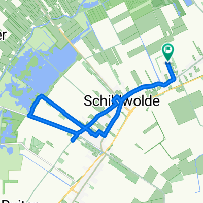
Rondje Schildmeer
A cycling route starting in Slochteren, Province of Groningen, The Netherlands.
Overview
About this route
Van Hellum via Steendam-Overschild naar Schildwolde
- -:--
- Duration
- 21.7 km
- Distance
- 4 m
- Ascent
- 4 m
- Descent
- ---
- Avg. speed
- ---
- Max. altitude
Route quality
Waytypes & surfaces along the route
Waytypes
Cycleway
8.2 km
(38 %)
Road
7.8 km
(36 %)
Surfaces
Paved
16.1 km
(74 %)
Asphalt
11.3 km
(52 %)
Concrete
4.8 km
(22 %)
Undefined
5.6 km
(26 %)
Continue with Bikemap
Use, edit, or download this cycling route
You would like to ride Rondje Schildmeer or customize it for your own trip? Here is what you can do with this Bikemap route:
Free features
- Save this route as favorite or in collections
- Copy & plan your own version of this route
- Sync your route with Garmin or Wahoo
Premium features
Free trial for 3 days, or one-time payment. More about Bikemap Premium.
- Navigate this route on iOS & Android
- Export a GPX / KML file of this route
- Create your custom printout (try it for free)
- Download this route for offline navigation
Discover more Premium features.
Get Bikemap PremiumFrom our community
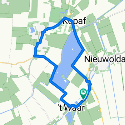
Other popular routes starting in Slochteren
 Rondje Schildmeer
- Distance
- 21.7 km
- Ascent
- 4 m
- Descent
- 4 m
- Location
- Slochteren, Province of Groningen, The Netherlands
 Froombosch 1
- Distance
- 28.7 km
- Ascent
- 4 m
- Descent
- 4 m
- Location
- Slochteren, Province of Groningen, The Netherlands
 Rondje open monumentendag
- Distance
- 14.7 km
- Ascent
- 0 m
- Descent
- 0 m
- Location
- Slochteren, Province of Groningen, The Netherlands
 to school
- Distance
- 8.3 km
- Ascent
- 167 m
- Descent
- 199 m
- Location
- Slochteren, Province of Groningen, The Netherlands
 23.08.15 Hoogezand etc.
- Distance
- 51.8 km
- Ascent
- 31 m
- Descent
- 31 m
- Location
- Slochteren, Province of Groningen, The Netherlands
 Hoofdweg 135, Wagenborgen naar Hoofdweg 135, Wagenborgen
- Distance
- 7.5 km
- Ascent
- 0 m
- Descent
- 0 m
- Location
- Slochteren, Province of Groningen, The Netherlands
 Italiaanse week Harkstede
- Distance
- 73.8 km
- Ascent
- 49 m
- Descent
- 50 m
- Location
- Slochteren, Province of Groningen, The Netherlands
 rondje hondshalstermeer langs de spar in wagenborgen
- Distance
- 11.7 km
- Ascent
- 0 m
- Descent
- 0 m
- Location
- Slochteren, Province of Groningen, The Netherlands
Open it in the app