

2018 - Ruta Nº 064
A cycling route starting in Valladolid, Castille and León, Spain.
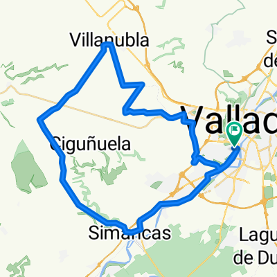
Overview
About this route
(Ronda este) - Ctra.Segovia - (via servicio) - Aldeamayor - La Pedraja - Mojados - Megeces - San Miguel del Arroyo - Viloria del Henar - Montemayor - Tudela - Valladolid
1ª Subida: Monte Carbonero
Pendiente media 5,40%
Distancia 2,6 Km.
- -:--
- Duration
- 97.9 km
- Distance
- 424 m
- Ascent
- 423 m
- Descent
- ---
- Avg. speed
- ---
- Max. altitude

Route quality
Waytypes & surfaces along the route
Waytypes
Road
55.8 km
(57 %)
Track
16.6 km
(17 %)
Surfaces
Paved
67.5 km
(69 %)
Unpaved
6.9 km
(7 %)
Asphalt
67.5 km
(69 %)
Gravel
2.9 km
(3 %)
Route highlights
Points of interest along the route
Point of interest after 45.7 km
1ª Subida: Monte Carbonero P.Media 5,40% Longitud 2,6 Km.
Continue with Bikemap
Use, edit, or download this cycling route
You would like to ride 2018 - Ruta Nº 064 or customize it for your own trip? Here is what you can do with this Bikemap route:
Free features
- Save this route as favorite or in collections
- Copy & plan your own version of this route
- Split it into stages to create a multi-day tour
- Sync your route with Garmin or Wahoo
Premium features
Free trial for 3 days, or one-time payment. More about Bikemap Premium.
- Navigate this route on iOS & Android
- Export a GPX / KML file of this route
- Create your custom printout (try it for free)
- Download this route for offline navigation
Discover more Premium features.
Get Bikemap PremiumFrom our community
Other popular routes starting in Valladolid
 2022 - Ruta nº 059
- Distance
- 130.1 km
- Ascent
- 733 m
- Descent
- 733 m
- Location
- Valladolid, Castille and León, Spain
 Orilla Rio
- Distance
- 40.3 km
- Ascent
- 115 m
- Descent
- 115 m
- Location
- Valladolid, Castille and León, Spain
 Zaratán - Villanubla - Simancas
- Distance
- 44.5 km
- Ascent
- 254 m
- Descent
- 255 m
- Location
- Valladolid, Castille and León, Spain
 2021 - Ruta nº 51
- Distance
- 84.5 km
- Ascent
- 390 m
- Descent
- 384 m
- Location
- Valladolid, Castille and León, Spain
 Ciguñuela
- Distance
- 16.3 km
- Ascent
- 200 m
- Descent
- 103 m
- Location
- Valladolid, Castille and León, Spain
 2022 - Ruta nº 063
- Distance
- 100.1 km
- Ascent
- 201 m
- Descent
- 199 m
- Location
- Valladolid, Castille and León, Spain
 2022 - Ruta nº 062
- Distance
- 118.5 km
- Ascent
- 683 m
- Descent
- 686 m
- Location
- Valladolid, Castille and León, Spain
 Ruta: 20-Mayo-2018 - (PM - Amistad)
- Distance
- 92.8 km
- Ascent
- 435 m
- Descent
- 431 m
- Location
- Valladolid, Castille and León, Spain
Open it in the app