

Francia Alpok 08
A cycling route starting in Gap, Provence-Alpes-Côte d'Azur Region, France.
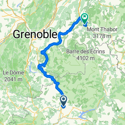
Overview
About this route
Col de Parquetout (1382 m) (térképen meg 1450) Col d'Ornon (1360 m)
- -:--
- Duration
- 98.6 km
- Distance
- 1,637 m
- Ascent
- 1,864 m
- Descent
- ---
- Avg. speed
- ---
- Max. altitude

Route quality
Waytypes & surfaces along the route
Waytypes
Busy road
74.5 km
(76 %)
Road
17.1 km
(17 %)
Surfaces
Paved
44.4 km
(45 %)
Unpaved
0.8 km
(<1 %)
Asphalt
44.4 km
(45 %)
Ground
0.8 km
(<1 %)
Undefined
53.3 km
(54 %)
Route highlights
Points of interest along the route
Point of interest after 61.3 km
Col de Parquetout (1382 m) (térképen meg 1450)
Point of interest after 83.9 km
Col d'Ornon (1360 m)
Continue with Bikemap
Use, edit, or download this cycling route
You would like to ride Francia Alpok 08 or customize it for your own trip? Here is what you can do with this Bikemap route:
Free features
- Save this route as favorite or in collections
- Copy & plan your own version of this route
- Split it into stages to create a multi-day tour
- Sync your route with Garmin or Wahoo
Premium features
Free trial for 3 days, or one-time payment. More about Bikemap Premium.
- Navigate this route on iOS & Android
- Export a GPX / KML file of this route
- Create your custom printout (try it for free)
- Download this route for offline navigation
Discover more Premium features.
Get Bikemap PremiumFrom our community
Other popular routes starting in Gap
 Gap - L'Hermitage 46k
- Distance
- 47.1 km
- Ascent
- 782 m
- Descent
- 785 m
- Location
- Gap, Provence-Alpes-Côte d'Azur Region, France
 Tour de France 2015 - Stage 18
- Distance
- 190.3 km
- Ascent
- 3,252 m
- Descent
- 3,447 m
- Location
- Gap, Provence-Alpes-Côte d'Azur Region, France
 France : Gap - Romans-sur-Isère
- Distance
- 171.9 km
- Ascent
- 827 m
- Descent
- 1,412 m
- Location
- Gap, Provence-Alpes-Côte d'Azur Region, France
 2016 Ride Day 86 - Gap to Jansac
- Distance
- 83.5 km
- Ascent
- 923 m
- Descent
- 975 m
- Location
- Gap, Provence-Alpes-Côte d'Azur Region, France
 HeroÏca by GravelbyBarnel Gap Cuneo
- Distance
- 319.8 km
- Ascent
- 6,477 m
- Descent
- 6,693 m
- Location
- Gap, Provence-Alpes-Côte d'Azur Region, France
 De Ä£@Ú? à Ä£@Ú?
- Distance
- 97.9 km
- Ascent
- 1,970 m
- Descent
- 1,970 m
- Location
- Gap, Provence-Alpes-Côte d'Azur Region, France
 montcolombis
- Distance
- 89.8 km
- Ascent
- 2,278 m
- Descent
- 2,276 m
- Location
- Gap, Provence-Alpes-Côte d'Azur Region, France
 Tour sympa au départ de Gap
- Distance
- 82 km
- Ascent
- 1,340 m
- Descent
- 1,332 m
- Location
- Gap, Provence-Alpes-Côte d'Azur Region, France
Open it in the app