02_Castillo_Fuensanta_LasCasillas_Ahillos
A cycling route starting in Castillo de Locubín, Andalusia, Spain.
Overview
About this route
Circular route starting from Castillo de Locubín on tertiary roads, passing through Hoyo de Piedra to Fuensanta, continuing through Las Casillas de Martos and the dam of the Víbora River. Finally, the Sierra Ahillos, with spectacular views of the region.
- -:--
- Duration
- 79.7 km
- Distance
- 1,358 m
- Ascent
- 1,390 m
- Descent
- ---
- Avg. speed
- ---
- Max. altitude
Continue with Bikemap
Use, edit, or download this cycling route
You would like to ride 02_Castillo_Fuensanta_LasCasillas_Ahillos or customize it for your own trip? Here is what you can do with this Bikemap route:
Free features
- Save this route as favorite or in collections
- Copy & plan your own version of this route
- Sync your route with Garmin or Wahoo
Premium features
Free trial for 3 days, or one-time payment. More about Bikemap Premium.
- Navigate this route on iOS & Android
- Export a GPX / KML file of this route
- Create your custom printout (try it for free)
- Download this route for offline navigation
Discover more Premium features.
Get Bikemap PremiumFrom our community
Other popular routes starting in Castillo de Locubín
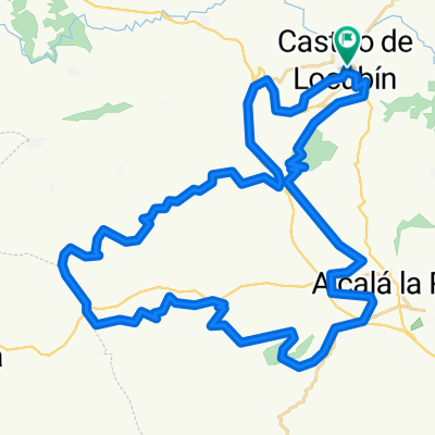
- Castillo de Locubin Estacion esqui sierra nevada
- Distance
- 127.7 km
- Ascent
- 1,919 m
- Descent
- 1,882 m
- Location
- Castillo de Locubín, Andalusia, Spain
- Proyecto - Castillo de Locubín - Jaén - Coberteras
- Distance
- 99.9 km
- Ascent
- 1,945 m
- Descent
- 1,947 m
- Location
- Castillo de Locubín, Andalusia, Spain
- CRONO 2016 (18/04/2016)
- Distance
- 5.4 km
- Ascent
- 180 m
- Descent
- 176 m
- Location
- Castillo de Locubín, Andalusia, Spain
- ruta experimental
- Distance
- 35 km
- Ascent
- 1,007 m
- Descent
- 998 m
- Location
- Castillo de Locubín, Andalusia, Spain
- 02_Castillo_Fuensanta_LasCasillas_Ahillos
- Distance
- 79.7 km
- Ascent
- 1,358 m
- Descent
- 1,390 m
- Location
- Castillo de Locubín, Andalusia, Spain
- 01_Castillo_Martina_HoyaSalobral_Castillo
- Distance
- 61.7 km
- Ascent
- 1,217 m
- Descent
- 1,224 m
- Location
- Castillo de Locubín, Andalusia, Spain
- Castillo_Puerto_Locubin_Frailes
- Distance
- 49.9 km
- Ascent
- 938 m
- Descent
- 945 m
- Location
- Castillo de Locubín, Andalusia, Spain
- Brevet Randonneur 300K Rs Azahar (Castillo Locubín)
- Distance
- 288.1 km
- Ascent
- 4,492 m
- Descent
- 4,493 m
- Location
- Castillo de Locubín, Andalusia, Spain
Open it in the app