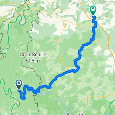
Chasse aux cols Charleville Mezières
A cycling route starting in Thilay, Grand Est, France.
Overview
About this route
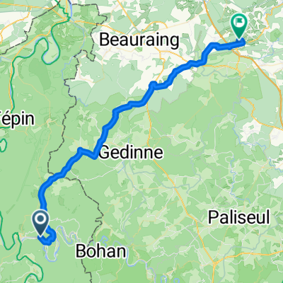
Hunting passes Charleville Mézières
- -:--
- Duration
- 109 km
- Distance
- 892 m
- Ascent
- 887 m
- Descent
- ---
- Avg. speed
- ---
- Max. altitude
Route quality
Waytypes & surfaces along the route
Waytypes
Road
32.7 km
(30 %)
Quiet road
17.4 km
(16 %)
Surfaces
Paved
44.7 km
(41 %)
Unpaved
3.3 km
(3 %)
Asphalt
44.7 km
(41 %)
Ground
2.2 km
(2 %)
Continue with Bikemap
Use, edit, or download this cycling route
You would like to ride Chasse aux cols Charleville Mezières or customize it for your own trip? Here is what you can do with this Bikemap route:
Free features
- Save this route as favorite or in collections
- Copy & plan your own version of this route
- Split it into stages to create a multi-day tour
- Sync your route with Garmin or Wahoo
Premium features
Free trial for 3 days, or one-time payment. More about Bikemap Premium.
- Navigate this route on iOS & Android
- Export a GPX / KML file of this route
- Create your custom printout (try it for free)
- Download this route for offline navigation
Discover more Premium features.
Get Bikemap PremiumFrom our community
Other popular routes starting in Thilay
- le valy 50km-1820hm
- Distance
- 50.8 km
- Ascent
- 1,698 m
- Descent
- 1,699 m
- Location
- Thilay, Grand Est, France
- De 1 Rue du Port, Bogny-sur-Meuse à 1 Rue du Port, Bogny-sur-Meuse
- Distance
- 40.3 km
- Ascent
- 189 m
- Descent
- 204 m
- Location
- Thilay, Grand Est, France
- Bike Park Tournaveaux
- Distance
- 20.4 km
- Ascent
- 1,321 m
- Descent
- 1,335 m
- Location
- Thilay, Grand Est, France
- VII. day Thilay(F)Kemmel (B)
- Distance
- 344.5 km
- Ascent
- 1,042 m
- Descent
- 1,138 m
- Location
- Thilay, Grand Est, France
- option 2
- Distance
- 49.6 km
- Ascent
- 967 m
- Descent
- 885 m
- Location
- Thilay, Grand Est, France
- BikeTrip-Belgique_août2014
- Distance
- 851 km
- Ascent
- 741 m
- Descent
- 741 m
- Location
- Thilay, Grand Est, France
- fumay
- Distance
- 36.1 km
- Ascent
- 622 m
- Descent
- 622 m
- Location
- Thilay, Grand Est, France
- Route sans nom, Haulmé naar Quai Aristide Briand 7, Monthermé
- Distance
- 38.2 km
- Ascent
- 871 m
- Descent
- 892 m
- Location
- Thilay, Grand Est, France
Open it in the app