

Frankenrunde Tauber zum Main und zurück CLONED FROM ROUTE 288271
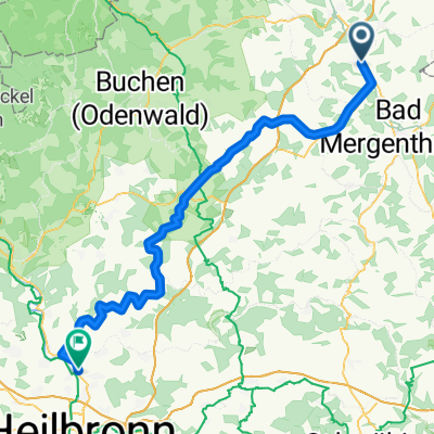
A cycling route starting in Lauda-Königshofen, Baden-Wurttemberg, Germany.
Overview
About this route
Mostly main roads with little traffic to Würzburg along the railway line, then along the Main river to Ochsenfurt and back home via Tückelhausen!
- -:--
- Duration
- 97.4 km
- Distance
- 846 m
- Ascent
- 855 m
- Descent
- ---
- Avg. speed
- 354 m
- Max. altitude

Route quality
Waytypes & surfaces along the route
Waytypes
Road
30.2 km
(31 %)
Track
11.7 km
(12 %)
Surfaces
Paved
71.1 km
(73 %)
Asphalt
70.1 km
(72 %)
Paved (undefined)
1 km
(1 %)
Undefined
26.3 km
(27 %)
Route highlights
Points of interest along the route
Point of interest after 44.9 km
Weingut Gebhart super Secco Rot haut einen fast......
Point of interest after 51.7 km
Ochsenfurter Rathaus hat ein Spiel wie in Rothenburg jeweils zu vollen Stunde!!!
Point of interest after 86.8 km
Rast bei Familie Haun!!!
Continue with Bikemap
Use, edit, or download this cycling route
You would like to ride Frankenrunde Tauber zum Main und zurück CLONED FROM ROUTE 288271 or customize it for your own trip? Here is what you can do with this Bikemap route:
Free features
- Save this route as favorite or in collections
- Copy & plan your own version of this route
- Split it into stages to create a multi-day tour
- Sync your route with Garmin or Wahoo
Premium features
Free trial for 3 days, or one-time payment. More about Bikemap Premium.
- Navigate this route on iOS & Android
- Export a GPX / KML file of this route
- Create your custom printout (try it for free)
- Download this route for offline navigation
Discover more Premium features.
Get Bikemap PremiumFrom our community
Other popular routes starting in Lauda-Königshofen
 MTB Lauda Römerweg-Osterloch Runde
- Distance
- 39.9 km
- Ascent
- 596 m
- Descent
- 596 m
- Location
- Lauda-Königshofen, Baden-Wurttemberg, Germany
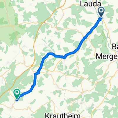
 Lauda - Königshofen - Boxberg - Osterburken - Möckmühl - Jagsttal - BFH Schillerstr.
- Distance
- 80.8 km
- Ascent
- 266 m
- Descent
- 289 m
- Location
- Lauda-Königshofen, Baden-Wurttemberg, Germany
 Rundfahrt durchs Mittlere Taubertal
- Distance
- 84.6 km
- Ascent
- 720 m
- Descent
- 725 m
- Location
- Lauda-Königshofen, Baden-Wurttemberg, Germany
 Baulandrunde
- Distance
- 57.2 km
- Ascent
- 614 m
- Descent
- 603 m
- Location
- Lauda-Königshofen, Baden-Wurttemberg, Germany
 Kirchstraße, Lauda-Königshofen nach Richard-Wagner-Straße, Ravenstein
- Distance
- 25.9 km
- Ascent
- 355 m
- Descent
- 254 m
- Location
- Lauda-Königshofen, Baden-Wurttemberg, Germany
 kurze Bergsprints
- Distance
- 14.3 km
- Ascent
- 133 m
- Descent
- 90 m
- Location
- Lauda-Königshofen, Baden-Wurttemberg, Germany
 Trainingsrunde
- Distance
- 81 km
- Ascent
- 409 m
- Descent
- 394 m
- Location
- Lauda-Königshofen, Baden-Wurttemberg, Germany
 N° 1 | E-Bike Teststrecke auf den Schmachtenberg
- Distance
- 8.8 km
- Ascent
- 142 m
- Descent
- 139 m
- Location
- Lauda-Königshofen, Baden-Wurttemberg, Germany
Open it in the app