

09 Hongrie
A cycling route starting in Rudabánya, Borsod-Abauj Zemplen county, Hungary.
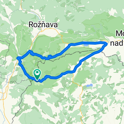
Overview
About this route
From the Slovak border to Slovenia
- -:--
- Duration
- 518.8 km
- Distance
- 780 m
- Ascent
- 955 m
- Descent
- ---
- Avg. speed
- ---
- Max. altitude

Route quality
Waytypes & surfaces along the route
Waytypes
Cycleway
108.9 km
(21 %)
Quiet road
103.8 km
(20 %)
Surfaces
Paved
337.2 km
(65 %)
Unpaved
10.4 km
(2 %)
Asphalt
332 km
(64 %)
Paved (undefined)
5.2 km
(1 %)
Continue with Bikemap
Use, edit, or download this cycling route
You would like to ride 09 Hongrie or customize it for your own trip? Here is what you can do with this Bikemap route:
Free features
- Save this route as favorite or in collections
- Copy & plan your own version of this route
- Split it into stages to create a multi-day tour
- Sync your route with Garmin or Wahoo
Premium features
Free trial for 3 days, or one-time payment. More about Bikemap Premium.
- Navigate this route on iOS & Android
- Export a GPX / KML file of this route
- Create your custom printout (try it for free)
- Download this route for offline navigation
Discover more Premium features.
Get Bikemap PremiumFrom our community
Other popular routes starting in Rudabánya
 Poprad - Eger 4. deň
- Distance
- 98.4 km
- Ascent
- 969 m
- Descent
- 1,040 m
- Location
- Rudabánya, Borsod-Abauj Zemplen county, Hungary
 Aggtelek 5.
- Distance
- 23.7 km
- Ascent
- 139 m
- Descent
- 262 m
- Location
- Rudabánya, Borsod-Abauj Zemplen county, Hungary
 OKT Gömöri Kék 2
- Distance
- 22.4 km
- Ascent
- 512 m
- Descent
- 506 m
- Location
- Rudabánya, Borsod-Abauj Zemplen county, Hungary
 2. kerékpáros túra - 3. etap
- Distance
- 78.5 km
- Ascent
- 195 m
- Descent
- 406 m
- Location
- Rudabánya, Borsod-Abauj Zemplen county, Hungary
 Szelce kör
- Distance
- 34.2 km
- Ascent
- 353 m
- Descent
- 355 m
- Location
- Rudabánya, Borsod-Abauj Zemplen county, Hungary
 09 Hongrie
- Distance
- 518.8 km
- Ascent
- 780 m
- Descent
- 955 m
- Location
- Rudabánya, Borsod-Abauj Zemplen county, Hungary
 Északi Zöld 10
- Distance
- 27.8 km
- Ascent
- 203 m
- Descent
- 381 m
- Location
- Rudabánya, Borsod-Abauj Zemplen county, Hungary
 SZLOVÁKIA 1
- Distance
- 93.2 km
- Ascent
- 636 m
- Descent
- 632 m
- Location
- Rudabánya, Borsod-Abauj Zemplen county, Hungary
Open it in the app