

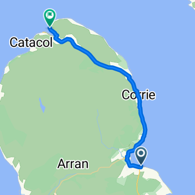
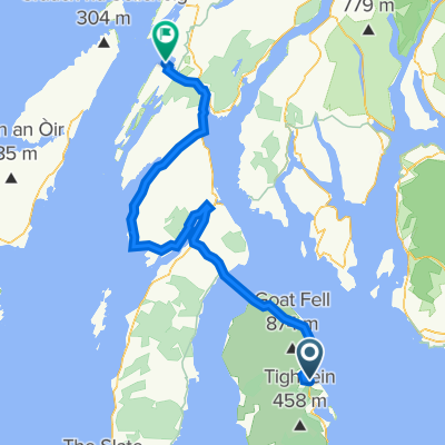
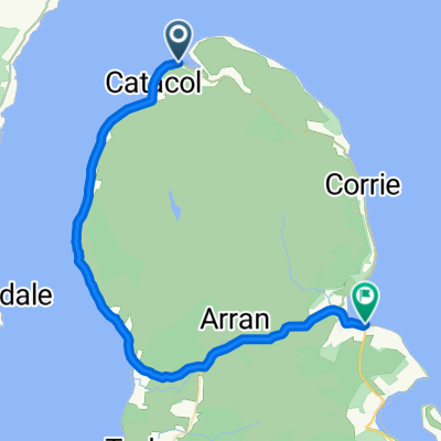
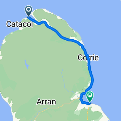
Brodick to Oban
A cycling route starting in Isle of Arran, Scotland, United Kingdom.
Overview
About this route
<span style="color: #000000; font-family: Times; font-size: medium;"> </span> <div style="background-image: initial; background-repeat: initial; background-attachment: initial; -webkit-background-clip: initial; -webkit-background-origin: initial; background-color: #ffffff; color: #535353; font-family: Verdana, Arial, Helvetica, sans-serif; font-size: 10px; background-position: initial initial; margin: 8px;">
<div style="background-image: initial; background-repeat: initial; background-attachment: initial; -webkit-background-clip: initial; -webkit-background-origin: initial; background-color: #ffffff; color: #535353; font-family: Verdana, Arial, Helvetica, sans-serif; font-size: 10px; margin: 8px;"> <div style="background-image: initial; background-repeat: initial; background-attachment: initial; -webkit-background-clip: initial; -webkit-background-origin: initial; background-color: #ffffff; color: #535353; font-family: Verdana, Arial, Helvetica, sans-serif; font-size: 10px; margin: 8px;">
Day 11 of my 2003 Land's End to John O'Groats cycle ride. </div> </div>
</div>
- -:--
- Duration
- 127.6 km
- Distance
- 1,489 m
- Ascent
- 1,443 m
- Descent
- ---
- Avg. speed
- 202 m
- Max. altitude

Route quality
Waytypes & surfaces along the route
Waytypes
Cycleway
35.7 km
(28 %)
Quiet road
1.3 km
(1 %)
Surfaces
Paved
86.8 km
(68 %)
Asphalt
86.8 km
(68 %)
Undefined
40.8 km
(32 %)
Continue with Bikemap
Use, edit, or download this cycling route
You would like to ride Brodick to Oban or customize it for your own trip? Here is what you can do with this Bikemap route:
Free features
- Save this route as favorite or in collections
- Copy & plan your own version of this route
- Split it into stages to create a multi-day tour
- Sync your route with Garmin or Wahoo
Premium features
Free trial for 3 days, or one-time payment. More about Bikemap Premium.
- Navigate this route on iOS & Android
- Export a GPX / KML file of this route
- Create your custom printout (try it for free)
- Download this route for offline navigation
Discover more Premium features.
Get Bikemap PremiumFrom our community
Other popular routes starting in Isle of Arran
 Brodick to Oban
- Distance
- 127.6 km
- Ascent
- 1,489 m
- Descent
- 1,443 m
- Location
- Isle of Arran, Scotland, United Kingdom
 Blackwaterfoot - Brodick Ferry Terminal
- Distance
- 18.6 km
- Ascent
- 274 m
- Descent
- 274 m
- Location
- Isle of Arran, Scotland, United Kingdom
 The String nach The String
- Distance
- 65.3 km
- Ascent
- 854 m
- Descent
- 854 m
- Location
- Isle of Arran, Scotland, United Kingdom
 Brodick Terminal - Newton Road End
- Distance
- 24 km
- Ascent
- 334 m
- Descent
- 330 m
- Location
- Isle of Arran, Scotland, United Kingdom
 LEJO'G 18 Brodick, Isle of Arran to Crinan
- Distance
- 112.3 km
- Ascent
- 1,296 m
- Descent
- 1,299 m
- Location
- Isle of Arran, Scotland, United Kingdom
 Lochranza Terminal - Brodick Terminal
- Distance
- 36.2 km
- Ascent
- 430 m
- Descent
- 434 m
- Location
- Isle of Arran, Scotland, United Kingdom
 Lochranza Terminal - Brodick Terminal
- Distance
- 23.8 km
- Ascent
- 336 m
- Descent
- 341 m
- Location
- Isle of Arran, Scotland, United Kingdom
 LEJOG Day 10b - Ardrossan - Broddick ferry - Lochranza
- Distance
- 22.8 km
- Ascent
- 301 m
- Descent
- 298 m
- Location
- Isle of Arran, Scotland, United Kingdom
Open it in the app