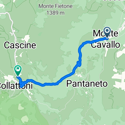
Monte Cavallo Colfiorito
A cycling route starting in Pie' del Sasso, The Marches, Italy.
Overview
About this route
Da Monte Cavallo verso la piana di Colfiorito e ritorno in circuito
- -:--
- Duration
- 36.3 km
- Distance
- 974 m
- Ascent
- 974 m
- Descent
- ---
- Avg. speed
- ---
- Avg. speed
Route quality
Waytypes & surfaces along the route
Waytypes
Busy road
13.2 km
(36 %)
Road
11.4 km
(31 %)
Surfaces
Paved
17.8 km
(49 %)
Unpaved
6.2 km
(17 %)
Asphalt
17.8 km
(49 %)
Gravel
6.2 km
(17 %)
Undefined
12.3 km
(34 %)
Continue with Bikemap
Use, edit, or download this cycling route
You would like to ride Monte Cavallo Colfiorito or customize it for your own trip? Here is what you can do with this Bikemap route:
Free features
- Save this route as favorite or in collections
- Copy & plan your own version of this route
- Sync your route with Garmin or Wahoo
Premium features
Free trial for 3 days, or one-time payment. More about Bikemap Premium.
- Navigate this route on iOS & Android
- Export a GPX / KML file of this route
- Create your custom printout (try it for free)
- Download this route for offline navigation
Discover more Premium features.
Get Bikemap PremiumFrom our community
Other popular routes starting in Pie' del Sasso
- Pantaneto (MC) • Cima Corno
- Distance
- 16.6 km
- Ascent
- 616 m
- Descent
- 616 m
- Location
- Pie' del Sasso, The Marches, Italy
- Montecavallo-Visso-Montecavallo
- Distance
- 43.6 km
- Ascent
- 1,366 m
- Descent
- 1,386 m
- Location
- Pie' del Sasso, The Marches, Italy
- Monte Cavallo - Frontignano di Ussita
- Distance
- 63 km
- Ascent
- 1,193 m
- Descent
- 1,193 m
- Location
- Pie' del Sasso, The Marches, Italy
- MONTE CAVALLO (MC) • North ring
- Distance
- 28.8 km
- Ascent
- 1,009 m
- Descent
- 1,006 m
- Location
- Pie' del Sasso, The Marches, Italy
- Monte Cavallo Colfiorito
- Distance
- 36.3 km
- Ascent
- 974 m
- Descent
- 974 m
- Location
- Pie' del Sasso, The Marches, Italy
- Montecavallo - Torricchio
- Distance
- 25.5 km
- Ascent
- 790 m
- Descent
- 790 m
- Location
- Pie' del Sasso, The Marches, Italy
- MONTE FEMA
- Distance
- 24.3 km
- Ascent
- 1,368 m
- Descent
- 1,349 m
- Location
- Pie' del Sasso, The Marches, Italy
- Traccia 16/mar/2014 08:15:44
- Distance
- 29.4 km
- Ascent
- 1,423 m
- Descent
- 1,423 m
- Location
- Pie' del Sasso, The Marches, Italy
Open it in the app