

Nennhausener Land
A cycling route starting in Kotzen, Brandenburg, Germany.
Overview
About this route
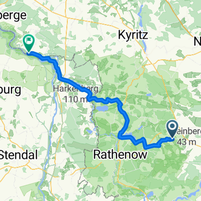
This cycling tour starts in Ferchesar and leads along the Kotzener Weg (also called Apfelweg) to the B188, alongside which lies the Stechow airfield. From there, you ride along the B188 and turn right towards Landin. From there, the route continues to Kriele. From there, you cycle a stretch on the Havelland-Radweg to Kotzen. Via agricultural paths, you reach Damme and then Liepe. There is a guesthouse in Liepe with a very beautiful outdoor area inviting you to linger. From Liepe, the route continues to Möthlow, Buschow, Barnewitz, Garlitz, Mützlitz, Gräningen to Nennhausen. From Nennhausen, you continue along the state road to Stechow and back to Ferchesar.
- -:--
- Duration
- 54 km
- Distance
- 110 m
- Ascent
- 113 m
- Descent
- ---
- Avg. speed
- ---
- Max. altitude
Route quality
Waytypes & surfaces along the route
Waytypes
Track
14.6 km
(27 %)
Road
12.4 km
(23 %)
Surfaces
Paved
34 km
(63 %)
Unpaved
10.3 km
(19 %)
Asphalt
28.6 km
(53 %)
Concrete
4.9 km
(9 %)
Continue with Bikemap
Use, edit, or download this cycling route
You would like to ride Nennhausener Land or customize it for your own trip? Here is what you can do with this Bikemap route:
Free features
- Save this route as favorite or in collections
- Copy & plan your own version of this route
- Sync your route with Garmin or Wahoo
Premium features
Free trial for 3 days, or one-time payment. More about Bikemap Premium.
- Navigate this route on iOS & Android
- Export a GPX / KML file of this route
- Create your custom printout (try it for free)
- Download this route for offline navigation
Discover more Premium features.
Get Bikemap PremiumFrom our community
Other popular routes starting in Kotzen
 Lochow - Witzke
- Distance
- 20.5 km
- Ascent
- 94 m
- Descent
- 94 m
- Location
- Kotzen, Brandenburg, Germany
 Kotzen - Rühstädt
- Distance
- 75.1 km
- Ascent
- 192 m
- Descent
- 196 m
- Location
- Kotzen, Brandenburg, Germany
 Dorfstraße 35, Stechow-Ferchesar nach Dorfstraße 5, Stechow-Ferchesar
- Distance
- 21.9 km
- Ascent
- 174 m
- Descent
- 162 m
- Location
- Kotzen, Brandenburg, Germany
 perm Hohe Rott
- Distance
- 76.2 km
- Ascent
- 163 m
- Descent
- 163 m
- Location
- Kotzen, Brandenburg, Germany
 perm Paulinenaue
- Distance
- 71.1 km
- Ascent
- 141 m
- Descent
- 141 m
- Location
- Kotzen, Brandenburg, Germany
 Friesacker Ländchen
- Distance
- 46.5 km
- Ascent
- 94 m
- Descent
- 93 m
- Location
- Kotzen, Brandenburg, Germany
 Land und Luch
- Distance
- 39.4 km
- Ascent
- 85 m
- Descent
- 83 m
- Location
- Kotzen, Brandenburg, Germany
 Rhinower Ländchen
- Distance
- 58.4 km
- Ascent
- 133 m
- Descent
- 133 m
- Location
- Kotzen, Brandenburg, Germany
Open it in the app