

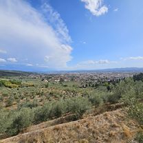
Toscana
A cycling route starting in Sesto Fiorentino, Tuscany, Italy.
Overview
About this route
Toscana
- -:--
- Duration
- 522 km
- Distance
- 3,151 m
- Ascent
- 3,150 m
- Descent
- ---
- Avg. speed
- ---
- Max. altitude

Route quality
Waytypes & surfaces along the route
Waytypes
Busy road
186.4 km
(36 %)
Road
145.8 km
(28 %)
Surfaces
Paved
332.1 km
(64 %)
Unpaved
35.7 km
(7 %)
Asphalt
326 km
(62 %)
Unpaved (undefined)
17.2 km
(3 %)
Continue with Bikemap
Use, edit, or download this cycling route
You would like to ride Toscana or customize it for your own trip? Here is what you can do with this Bikemap route:
Free features
- Save this route as favorite or in collections
- Copy & plan your own version of this route
- Split it into stages to create a multi-day tour
- Sync your route with Garmin or Wahoo
Premium features
Free trial for 3 days, or one-time payment. More about Bikemap Premium.
- Navigate this route on iOS & Android
- Export a GPX / KML file of this route
- Create your custom printout (try it for free)
- Download this route for offline navigation
Discover more Premium features.
Get Bikemap PremiumFrom our community
Other popular routes starting in Sesto Fiorentino
 Sunset urban trail - Mini
- Distance
- 6.3 km
- Ascent
- 445 m
- Descent
- 443 m
- Location
- Sesto Fiorentino, Tuscany, Italy
 Montagna pistoiese - Lungo
- Distance
- 234.8 km
- Ascent
- 3,274 m
- Descent
- 3,273 m
- Location
- Sesto Fiorentino, Tuscany, Italy
 casa-pistoia
- Distance
- 41.6 km
- Ascent
- 35 m
- Descent
- 30 m
- Location
- Sesto Fiorentino, Tuscany, Italy
 bdc giro barberino val d elsa pietrafitta panzano
- Distance
- 126.1 km
- Ascent
- 1,341 m
- Descent
- 1,341 m
- Location
- Sesto Fiorentino, Tuscany, Italy
 Colonnata - Le Cappelle - Sommaia - Il Ciliegio - Le Rocce - La Lea - Colonnata
- Distance
- 17.1 km
- Ascent
- 656 m
- Descent
- 658 m
- Location
- Sesto Fiorentino, Tuscany, Italy
 Sesto-sterrato
- Distance
- 20.4 km
- Ascent
- 52 m
- Descent
- 54 m
- Location
- Sesto Fiorentino, Tuscany, Italy
 Toscana
- Distance
- 522 km
- Ascent
- 3,151 m
- Descent
- 3,150 m
- Location
- Sesto Fiorentino, Tuscany, Italy
 Da Via Egizio Fiorelli a Via Luca della Robbia
- Distance
- 5.3 km
- Ascent
- 138 m
- Descent
- 205 m
- Location
- Sesto Fiorentino, Tuscany, Italy
Open it in the app