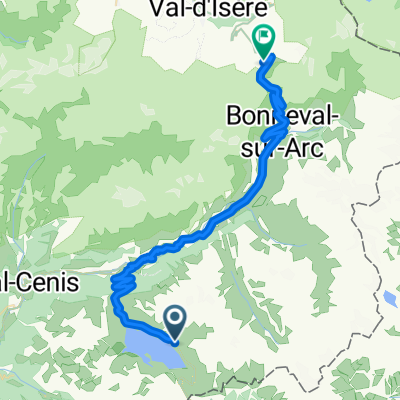
Fort Ronce
A cycling route starting in Moncenisio, Piedmont, Italy.
Overview
About this route
Offroad-Abstecher vom Lac du Mont Cenis zu einem ehemaligen italienischen Fort.
- -:--
- Duration
- 5.8 km
- Distance
- 264 m
- Ascent
- 231 m
- Descent
- ---
- Avg. speed
- ---
- Avg. speed
Route quality
Waytypes & surfaces along the route
Waytypes
Track
5.8 km
(100 %)
Busy road
0 km
(<1 %)
Surfaces
Paved
0 km
(<1 %)
Unpaved
5.8 km
(100 %)
Gravel
3.6 km
(62 %)
Unpaved (undefined)
2.1 km
(37 %)
Continue with Bikemap
Use, edit, or download this cycling route
You would like to ride Fort Ronce or customize it for your own trip? Here is what you can do with this Bikemap route:
Free features
- Save this route as favorite or in collections
- Copy & plan your own version of this route
- Sync your route with Garmin or Wahoo
Premium features
Free trial for 3 days, or one-time payment. More about Bikemap Premium.
- Navigate this route on iOS & Android
- Export a GPX / KML file of this route
- Create your custom printout (try it for free)
- Download this route for offline navigation
Discover more Premium features.
Get Bikemap PremiumFrom our community
Other popular routes starting in Moncenisio
- 21/08/2015: Primo giro del lago del Moncenisio
- Distance
- 18.3 km
- Ascent
- 367 m
- Descent
- 367 m
- Location
- Moncenisio, Piedmont, Italy
- turra
- Distance
- 20.6 km
- Ascent
- 1,449 m
- Descent
- 454 m
- Location
- Moncenisio, Piedmont, Italy
- Fort Malamot
- Distance
- 10.8 km
- Ascent
- 948 m
- Descent
- 80 m
- Location
- Moncenisio, Piedmont, Italy
- giro dei laghi intorno al Moncenisio
- Distance
- 22.3 km
- Ascent
- 857 m
- Descent
- 858 m
- Location
- Moncenisio, Piedmont, Italy
- RdGA - Stage 4 (start Moncenisio var Aussois)
- Distance
- 148.4 km
- Ascent
- 2,980 m
- Descent
- 3,198 m
- Location
- Moncenisio, Piedmont, Italy
- Fort Ronce
- Distance
- 5.8 km
- Ascent
- 264 m
- Descent
- 231 m
- Location
- Moncenisio, Piedmont, Italy
- LAC D'ARPON-PICCOLO MONCENISIO-FORT TURRA-LANSLEBOURG-COL DE LA MET
- Distance
- 64.6 km
- Ascent
- 2,614 m
- Descent
- 1,369 m
- Location
- Moncenisio, Piedmont, Italy
- T2F-2020-7.Col e Val d'Isère
- Distance
- 181.3 km
- Ascent
- 2,602 m
- Descent
- 3,168 m
- Location
- Moncenisio, Piedmont, Italy
Open it in the app