

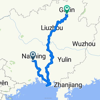
花山
A cycling route starting in Nanning, Guangxi, China.
Overview
About this route
22/01/2015 15:13
- -:--
- Duration
- 77.9 km
- Distance
- 291 m
- Ascent
- 298 m
- Descent
- ---
- Avg. speed
- ---
- Max. altitude
Continue with Bikemap
Use, edit, or download this cycling route
You would like to ride 花山 or customize it for your own trip? Here is what you can do with this Bikemap route:
Free features
- Save this route as favorite or in collections
- Copy & plan your own version of this route
- Sync your route with Garmin or Wahoo
Premium features
Free trial for 3 days, or one-time payment. More about Bikemap Premium.
- Navigate this route on iOS & Android
- Export a GPX / KML file of this route
- Create your custom printout (try it for free)
- Download this route for offline navigation
Discover more Premium features.
Get Bikemap PremiumFrom our community
Other popular routes starting in Nanning
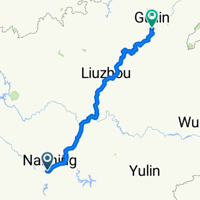
 Nanning - Beihai - Guilin
- Distance
- 1,273.4 km
- Ascent
- 12,368 m
- Descent
- 12,301 m
- Location
- Nanning, Guangxi, China
 Nanning Yibin
- Distance
- 1,073.9 km
- Ascent
- 16,643 m
- Descent
- 16,365 m
- Location
- Nanning, Guangxi, China
 Nanning - Dongxing schöne Route (mind. 3 Tage)
- Distance
- 236.4 km
- Ascent
- 1,181 m
- Descent
- 1,254 m
- Location
- Nanning, Guangxi, China
 flower market mountain
- Distance
- 24.7 km
- Ascent
- 205 m
- Descent
- 205 m
- Location
- Nanning, Guangxi, China
 Nanning to Pingxiang
- Distance
- 280 km
- Ascent
- 819 m
- Descent
- 693 m
- Location
- Nanning, Guangxi, China
 etapa 3
- Distance
- 31.6 km
- Ascent
- 299 m
- Descent
- 296 m
- Location
- Nanning, Guangxi, China
 Nanning - Guilin
- Distance
- 550.9 km
- Ascent
- 7,052 m
- Descent
- 6,985 m
- Location
- Nanning, Guangxi, China
 廣西南寧-西藏日喀則 單騎完成 (Sep-Dec 2009)
- Distance
- 4,058 km
- Ascent
- 14,047 m
- Descent
- 10,517 m
- Location
- Nanning, Guangxi, China
Open it in the app