

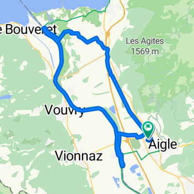
Complete Alpine Tour
A cycling route starting in Aigle, Canton of Vaud, Switzerland.
Overview
About this route
Complete Alpine Tour
- -:--
- Duration
- 506.5 km
- Distance
- 5,081 m
- Ascent
- 5,093 m
- Descent
- ---
- Avg. speed
- ---
- Max. altitude

Route quality
Waytypes & surfaces along the route
Waytypes
Quiet road
177.3 km
(35 %)
Road
116.5 km
(23 %)
Surfaces
Paved
344.4 km
(68 %)
Unpaved
25.3 km
(5 %)
Asphalt
324.2 km
(64 %)
Paved (undefined)
15.2 km
(3 %)
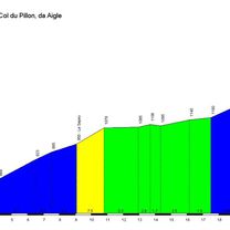
Route highlights
Points of interest along the route

Accommodation after 60.5 km
Hôtel de Gruyères, Gruyère

Accommodation after 152.3 km
Hotel Freienhof, Thun

Accommodation after 201 km
Hotel Kurhaus Swiss Spirit, Fluhli

Accommodation after 257.4 km
Hotel SEERAUSCH, Beckenried

Accommodation after 352.3 km
Hotel Rhodannenberg, Klontal

Accommodation after 437 km
Waldgasthaus Lehmen, Lehmen

Accommodation after 506.3 km
Hotel Metropol, Arbon
Continue with Bikemap
Use, edit, or download this cycling route
You would like to ride Complete Alpine Tour or customize it for your own trip? Here is what you can do with this Bikemap route:
Free features
- Save this route as favorite or in collections
- Copy & plan your own version of this route
- Split it into stages to create a multi-day tour
- Sync your route with Garmin or Wahoo
Premium features
Free trial for 3 days, or one-time payment. More about Bikemap Premium.
- Navigate this route on iOS & Android
- Export a GPX / KML file of this route
- Create your custom printout (try it for free)
- Download this route for offline navigation
Discover more Premium features.
Get Bikemap PremiumFrom our community
Other popular routes starting in Aigle
 47° Nord Tour de Suisse Etappe 4
- Distance
- 63.7 km
- Ascent
- 1,423 m
- Descent
- 938 m
- Location
- Aigle, Canton of Vaud, Switzerland
 2014-T12-Aigle-Moudon
- Distance
- 51.8 km
- Ascent
- 668 m
- Descent
- 552 m
- Location
- Aigle, Canton of Vaud, Switzerland
 Corbeyer- tour d'Aï- Via Ferrata
- Distance
- 16.2 km
- Ascent
- 1,374 m
- Descent
- 1,123 m
- Location
- Aigle, Canton of Vaud, Switzerland
 De Chemin de Pré d'Emoz 3, Aigle à Chemin de Pré d'Emoz 9, Aigle
- Distance
- 29.1 km
- Ascent
- 153 m
- Descent
- 160 m
- Location
- Aigle, Canton of Vaud, Switzerland
 Hongrin Loop
- Distance
- 55 km
- Ascent
- 2,167 m
- Descent
- 2,152 m
- Location
- Aigle, Canton of Vaud, Switzerland
 UCI Aigle - Villeneuve
- Distance
- 11.7 km
- Ascent
- 17 m
- Descent
- 27 m
- Location
- Aigle, Canton of Vaud, Switzerland
 Complete Alpine Tour
- Distance
- 506.5 km
- Ascent
- 5,081 m
- Descent
- 5,093 m
- Location
- Aigle, Canton of Vaud, Switzerland
 Etape 3 : Aigle - Gstaad (Tour de Suisse, Aramis) 40 km
- Distance
- 39.7 km
- Ascent
- 1,192 m
- Descent
- 601 m
- Location
- Aigle, Canton of Vaud, Switzerland
Open it in the app