

ONTARIO WATERFRONT TRAIL
A cycling route starting in Fort Erie, Ontario, Canada.
Overview
About this route
Bike cycling route following various trail systems along Lake Ontario shoreline from Fort Erie to Carrying Place near Trenton. Route is mostly paved and is a mix of trail paths and roads, takes in some tourist sites along route. One can expect some narrow back roads on this route.
- -:--
- Duration
- 422.7 km
- Distance
- 256 m
- Ascent
- 359 m
- Descent
- ---
- Avg. speed
- ---
- Max. altitude

Route quality
Waytypes & surfaces along the route
Waytypes
Quiet road
131 km
(31 %)
Cycleway
114.1 km
(27 %)
Surfaces
Paved
317 km
(75 %)
Unpaved
4.2 km
(1 %)
Asphalt
274.7 km
(65 %)
Paved (undefined)
38 km
(9 %)
Continue with Bikemap
Use, edit, or download this cycling route
You would like to ride ONTARIO WATERFRONT TRAIL or customize it for your own trip? Here is what you can do with this Bikemap route:
Free features
- Save this route as favorite or in collections
- Copy & plan your own version of this route
- Split it into stages to create a multi-day tour
- Sync your route with Garmin or Wahoo
Premium features
Free trial for 3 days, or one-time payment. More about Bikemap Premium.
- Navigate this route on iOS & Android
- Export a GPX / KML file of this route
- Create your custom printout (try it for free)
- Download this route for offline navigation
Discover more Premium features.
Get Bikemap PremiumFrom our community
Other popular routes starting in Fort Erie
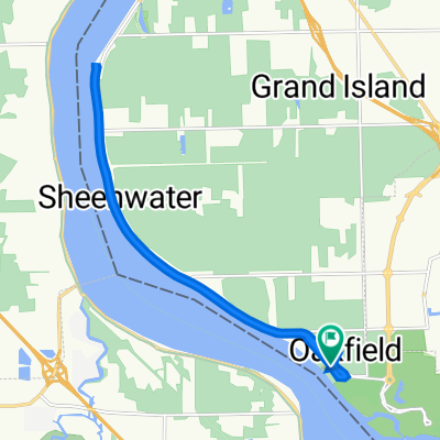
 2226 W Oakfield Rd, Grand Island to 2226 W Oakfield Rd, Grand Island
- Distance
- 17 km
- Ascent
- 41 m
- Descent
- 40 m
- Location
- Fort Erie, Ontario, Canada
 2226 W Oakfield Rd, Grand Island to 2226 W Oakfield Rd, Grand Island
- Distance
- 15.5 km
- Ascent
- 13 m
- Descent
- 16 m
- Location
- Fort Erie, Ontario, Canada
 Ruby Avenue 937, Fort Erie to Clarence Street 20, Port Colborne
- Distance
- 25.2 km
- Ascent
- 71 m
- Descent
- 86 m
- Location
- Fort Erie, Ontario, Canada
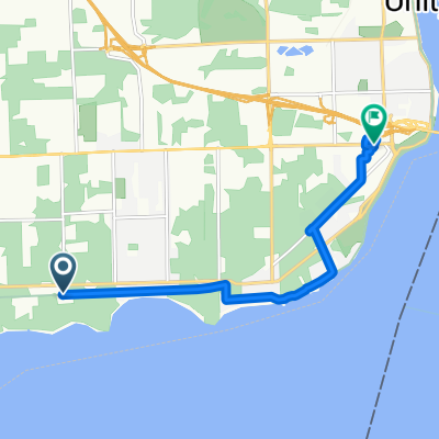
 63 Darwin Dr., Buffalo to 10969 Lakeshore Rd, Wainfleet
- Distance
- 141.2 km
- Ascent
- 134 m
- Descent
- 134 m
- Location
- Fort Erie, Ontario, Canada
 Ridgeway Road 528, Fort Erie to Ridgeway Road 528, Fort Erie
- Distance
- 25.2 km
- Ascent
- 60 m
- Descent
- 56 m
- Location
- Fort Erie, Ontario, Canada
 Great Lakes Waterfront Tr, Fort Erie to 200 Garrison Rd, Fort Erie
- Distance
- 7.8 km
- Ascent
- 202 m
- Descent
- 196 m
- Location
- Fort Erie, Ontario, Canada
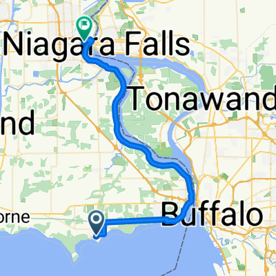 Derby Rd, Fort Erie to Victoria Ave, Niagara Falls
- Distance
- 49 km
- Ascent
- 180 m
- Descent
- 169 m
- Location
- Fort Erie, Ontario, Canada
 Fort Erie to Chippewa
- Distance
- 28.6 km
- Ascent
- 47 m
- Descent
- 58 m
- Location
- Fort Erie, Ontario, Canada
Open it in the app