

ETT 2016 1. Etappe Mittag
A cycling route starting in Freudenstadt, Baden-Wurttemberg, Germany.
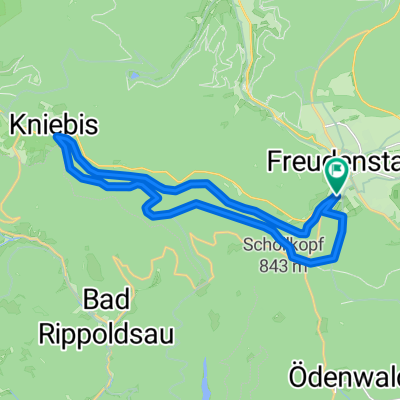
Overview
About this route
Freudenstadt - Offenburg Hotel Mercure Am Messeplatz
- -:--
- Duration
- 60.7 km
- Distance
- 476 m
- Ascent
- 983 m
- Descent
- ---
- Avg. speed
- ---
- Max. altitude

Route quality
Waytypes & surfaces along the route
Waytypes
Road
15.2 km
(25 %)
Path
3.6 km
(6 %)
Surfaces
Paved
47.9 km
(79 %)
Unpaved
1.8 km
(3 %)
Asphalt
47.3 km
(78 %)
Gravel
1.8 km
(3 %)
Continue with Bikemap
Use, edit, or download this cycling route
You would like to ride ETT 2016 1. Etappe Mittag or customize it for your own trip? Here is what you can do with this Bikemap route:
Free features
- Save this route as favorite or in collections
- Copy & plan your own version of this route
- Sync your route with Garmin or Wahoo
Premium features
Free trial for 3 days, or one-time payment. More about Bikemap Premium.
- Navigate this route on iOS & Android
- Export a GPX / KML file of this route
- Create your custom printout (try it for free)
- Download this route for offline navigation
Discover more Premium features.
Get Bikemap PremiumFrom our community
Other popular routes starting in Freudenstadt
 Schwarzwald Panorama-Radweg Tag 2
- Distance
- 59.1 km
- Ascent
- 528 m
- Descent
- 495 m
- Location
- Freudenstadt, Baden-Wurttemberg, Germany
 Schwarzwaldtour
- Distance
- 81.5 km
- Ascent
- 185 m
- Descent
- 692 m
- Location
- Freudenstadt, Baden-Wurttemberg, Germany
 Tour Schwarzwald - Kleines Kinzigtal
- Distance
- 41.6 km
- Ascent
- 674 m
- Descent
- 677 m
- Location
- Freudenstadt, Baden-Wurttemberg, Germany
 Von Freudenstadt bis Elzach
- Distance
- 73.1 km
- Ascent
- 1,891 m
- Descent
- 2,225 m
- Location
- Freudenstadt, Baden-Wurttemberg, Germany
 Freudenstadt für die Mittagspause
- Distance
- 19.7 km
- Ascent
- 294 m
- Descent
- 294 m
- Location
- Freudenstadt, Baden-Wurttemberg, Germany
 Sola aktuell Teil-2 Freudenstadt-Hardt
- Distance
- 41.8 km
- Ascent
- 610 m
- Descent
- 553 m
- Location
- Freudenstadt, Baden-Wurttemberg, Germany
 Kniebis- Baiersbronn runde
- Distance
- 31.6 km
- Ascent
- 549 m
- Descent
- 545 m
- Location
- Freudenstadt, Baden-Wurttemberg, Germany
 Zwei-Täler-Tour
- Distance
- 51.5 km
- Ascent
- 942 m
- Descent
- 942 m
- Location
- Freudenstadt, Baden-Wurttemberg, Germany
Open it in the app