

Aljažev dom 2015
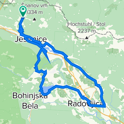
A cycling route starting in Hrušica, Jesenice, Slovenia.
Overview
About this route
Z Mojstrany kolem vodopádů Peričnik k Aljaževovu domu
- -:--
- Duration
- 10.6 km
- Distance
- 414 m
- Ascent
- 89 m
- Descent
- ---
- Avg. speed
- ---
- Max. altitude
Route quality
Waytypes & surfaces along the route
Waytypes
Road
9.3 km
(87 %)
Track
1 km
(10 %)
Surfaces
Paved
9.5 km
(89 %)
Unpaved
1 km
(10 %)
Asphalt
8.3 km
(78 %)
Paved (undefined)
1.2 km
(11 %)
Continue with Bikemap
Use, edit, or download this cycling route
You would like to ride Aljažev dom 2015 or customize it for your own trip? Here is what you can do with this Bikemap route:
Free features
- Save this route as favorite or in collections
- Copy & plan your own version of this route
- Sync your route with Garmin or Wahoo
Premium features
Free trial for 3 days, or one-time payment. More about Bikemap Premium.
- Navigate this route on iOS & Android
- Export a GPX / KML file of this route
- Create your custom printout (try it for free)
- Download this route for offline navigation
Discover more Premium features.
Get Bikemap PremiumFrom our community
Other popular routes starting in Hrušica
 Bledi tókerülés (hard core)
- Distance
- 56 km
- Ascent
- 979 m
- Descent
- 978 m
- Location
- Hrušica, Jesenice, Slovenia
 Mojstrana-italia-Vrsic-moistrana
- Distance
- 57.1 km
- Ascent
- 581 m
- Descent
- 582 m
- Location
- Hrušica, Jesenice, Slovenia
 Mojstrana - Vrata
- Distance
- 12 km
- Ascent
- 435 m
- Descent
- 65 m
- Location
- Hrušica, Jesenice, Slovenia
 Golica - kružna staza
- Distance
- 9.5 km
- Ascent
- 845 m
- Descent
- 852 m
- Location
- Hrušica, Jesenice, Slovenia
 Mojstrana-Bled
- Distance
- 45.7 km
- Ascent
- 536 m
- Descent
- 539 m
- Location
- Hrušica, Jesenice, Slovenia
 Mojstrana - Rifugio Zacchi - in nazaj
- Distance
- 65.4 km
- Ascent
- 1,066 m
- Descent
- 1,063 m
- Location
- Hrušica, Jesenice, Slovenia
 Mojstrana Tamar Mojstrana
- Distance
- 49.6 km
- Ascent
- 493 m
- Descent
- 493 m
- Location
- Hrušica, Jesenice, Slovenia
 3 Mojstrana-Lepena
- Distance
- 50.8 km
- Ascent
- 1,033 m
- Descent
- 1,199 m
- Location
- Hrušica, Jesenice, Slovenia
Open it in the app