

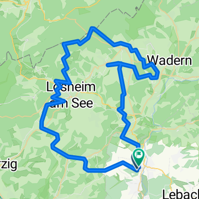
Wendelinus-Fahrt 2013 - RTF des RSC Haustadter Tal Reimsbach e.V. - 80 km Strecke
A cycling route starting in Schmelz, Saarland, Germany.
Overview
About this route
Wendelinus-Fahrt 2013 - 80 km
RTF of the Radsportclub Haustadter Tal Reimsbach e.V.
All further information about this route -> click here
- -:--
- Duration
- 72.4 km
- Distance
- 459 m
- Ascent
- 459 m
- Descent
- ---
- Avg. speed
- ---
- Max. altitude

Route highlights
Points of interest along the route
Point of interest after 24.2 km
Kontrolle Am Jungenwäldchen
Point of interest after 51.7 km
Kontrolle Wedern
Continue with Bikemap
Use, edit, or download this cycling route
You would like to ride Wendelinus-Fahrt 2013 - RTF des RSC Haustadter Tal Reimsbach e.V. - 80 km Strecke or customize it for your own trip? Here is what you can do with this Bikemap route:
Free features
- Save this route as favorite or in collections
- Copy & plan your own version of this route
- Sync your route with Garmin or Wahoo
Premium features
Free trial for 3 days, or one-time payment. More about Bikemap Premium.
- Navigate this route on iOS & Android
- Export a GPX / KML file of this route
- Create your custom printout (try it for free)
- Download this route for offline navigation
Discover more Premium features.
Get Bikemap PremiumFrom our community
Other popular routes starting in Schmelz
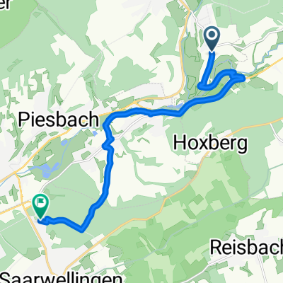
 Hochwaldtrail
- Distance
- 71.4 km
- Ascent
- 1,047 m
- Descent
- 1,050 m
- Location
- Schmelz, Saarland, Germany
 Wendelinus-Permanente 2013 - 80 km Perm. des RSC Haustadter Tal Reimsbach e.V.
- Distance
- 75.6 km
- Ascent
- 880 m
- Descent
- 886 m
- Location
- Schmelz, Saarland, Germany
 Fahrradtour Hamm´s Saarwellingen
- Distance
- 11.1 km
- Ascent
- 163 m
- Descent
- 179 m
- Location
- Schmelz, Saarland, Germany
 Limbach - Höchsten
- Distance
- 10.7 km
- Ascent
- 269 m
- Descent
- 268 m
- Location
- Schmelz, Saarland, Germany
 Limbach Hoxfels
- Distance
- 11.7 km
- Ascent
- 282 m
- Descent
- 281 m
- Location
- Schmelz, Saarland, Germany
 Mühlenbach und Schluchtenweg in Saarwelingen/Endsdorf
- Distance
- 38.8 km
- Ascent
- 288 m
- Descent
- 289 m
- Location
- Schmelz, Saarland, Germany
 Mövenmarathon 2008 - RTF des RV Möve Schmelz e.V. - 202 km Strecke
- Distance
- 200.1 km
- Ascent
- 1,450 m
- Descent
- 1,450 m
- Location
- Schmelz, Saarland, Germany
 Limbach zu Burg Dagstuhl
- Distance
- 21.2 km
- Ascent
- 266 m
- Descent
- 266 m
- Location
- Schmelz, Saarland, Germany
Open it in the app