

lidl-tour-2015-2-5
A cycling route starting in Val d'Isère, Auvergne-Rhône-Alpes, France.
Overview
About this route
savoyen-tour-2015
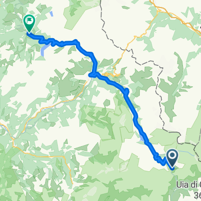
etappe 5
lanslevillard - col-du-meraillet
- -:--
- Duration
- 103.7 km
- Distance
- 2,541 m
- Ascent
- 2,402 m
- Descent
- ---
- Avg. speed
- ---
- Max. altitude
Continue with Bikemap
Use, edit, or download this cycling route
You would like to ride lidl-tour-2015-2-5 or customize it for your own trip? Here is what you can do with this Bikemap route:
Free features
- Save this route as favorite or in collections
- Copy & plan your own version of this route
- Split it into stages to create a multi-day tour
- Sync your route with Garmin or Wahoo
Premium features
Free trial for 3 days, or one-time payment. More about Bikemap Premium.
- Navigate this route on iOS & Android
- Export a GPX / KML file of this route
- Create your custom printout (try it for free)
- Download this route for offline navigation
Discover more Premium features.
Get Bikemap PremiumFrom our community
Other popular routes starting in Val d'Isère
 France Transalp Etappe4
- Distance
- 163.9 km
- Ascent
- 3,398 m
- Descent
- 3,845 m
- Location
- Val d'Isère, Auvergne-Rhône-Alpes, France
 d1 val d'isere - sees
- Distance
- 57.7 km
- Ascent
- 2,487 m
- Descent
- 3,451 m
- Location
- Val d'Isère, Auvergne-Rhône-Alpes, France
 Val-d'Isère - Beaufort
- Distance
- 77.5 km
- Ascent
- 929 m
- Descent
- 2,659 m
- Location
- Val d'Isère, Auvergne-Rhône-Alpes, France
 Route to Col de L'Iseran
- Distance
- 5.2 km
- Ascent
- 964 m
- Descent
- 0 m
- Location
- Val d'Isère, Auvergne-Rhône-Alpes, France
![[3.6] Val d'Isere---> Valoire](https://media.bikemap.net/routes/4671166/staticmaps/in_32d12d43-96c5-454d-bf1f-ec39c0715492_400x400_bikemap-2021-3D-static.png) [3.6] Val d'Isere---> Valoire
[3.6] Val d'Isere---> Valoire- Distance
- 106.7 km
- Ascent
- 1,930 m
- Descent
- 2,719 m
- Location
- Val d'Isère, Auvergne-Rhône-Alpes, France
 LANSLEVILLARD-AOSTA
- Distance
- 129.3 km
- Ascent
- 2,491 m
- Descent
- 3,365 m
- Location
- Val d'Isère, Auvergne-Rhône-Alpes, France
 ADH - Etappe2
- Distance
- 127.1 km
- Ascent
- 2,636 m
- Descent
- 3,500 m
- Location
- Val d'Isère, Auvergne-Rhône-Alpes, France
 Tag 7. Val d Isere - Briancon Alternativ
- Distance
- 159.9 km
- Ascent
- 3,013 m
- Descent
- 3,633 m
- Location
- Val d'Isère, Auvergne-Rhône-Alpes, France
Open it in the app