

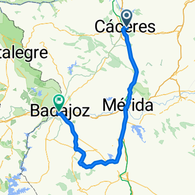
CACERES - BADAJOZ (LLA) ETAPA 2
A cycling route starting in Cáceres, Extremadura, Spain.
Overview
About this route
Stage two of the Vuelta between Cáceres and Badajoz featuring the climb to the Puerto de Las Crucitas, a 3rd category climb, 3 km at 4%.
- -:--
- Duration
- 209.8 km
- Distance
- 892 m
- Ascent
- 1,093 m
- Descent
- ---
- Avg. speed
- ---
- Max. altitude
Route quality
Waytypes & surfaces along the route
Waytypes
Cycleway
79.7 km
(38 %)
Road
52.4 km
(25 %)
Surfaces
Paved
94.4 km
(45 %)
Unpaved
12.6 km
(6 %)
Asphalt
65 km
(31 %)
Paved (undefined)
27.3 km
(13 %)
Route highlights
Points of interest along the route
Point of interest after 144.8 km
ALTO DE LAS CRUCITAS 3cat 3km - 4%
Continue with Bikemap
Use, edit, or download this cycling route
You would like to ride CACERES - BADAJOZ (LLA) ETAPA 2 or customize it for your own trip? Here is what you can do with this Bikemap route:
Free features
- Save this route as favorite or in collections
- Copy & plan your own version of this route
- Split it into stages to create a multi-day tour
- Sync your route with Garmin or Wahoo
Premium features
Free trial for 3 days, or one-time payment. More about Bikemap Premium.
- Navigate this route on iOS & Android
- Export a GPX / KML file of this route
- Create your custom printout (try it for free)
- Download this route for offline navigation
Discover more Premium features.
Get Bikemap PremiumFrom our community
Other popular routes starting in Cáceres
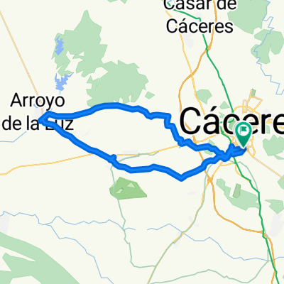
 CC - Barruecos - Cefot - CC
- Distance
- 38.9 km
- Ascent
- 204 m
- Descent
- 230 m
- Location
- Cáceres, Extremadura, Spain
 CASAR- RIBEROS MONROY
- Distance
- 73.6 km
- Ascent
- 543 m
- Descent
- 538 m
- Location
- Cáceres, Extremadura, Spain
 CACERES - BADAJOZ (LLA) ETAPA 2
- Distance
- 209.8 km
- Ascent
- 892 m
- Descent
- 1,093 m
- Location
- Cáceres, Extremadura, Spain
 Ruta de las Avutardas
- Distance
- 52.1 km
- Ascent
- 476 m
- Descent
- 476 m
- Location
- Cáceres, Extremadura, Spain
 6VP Cáceres - Carcaboso 98km
- Distance
- 98 km
- Ascent
- 1,351 m
- Descent
- 1,518 m
- Location
- Cáceres, Extremadura, Spain
 Perderse
- Distance
- 35.8 km
- Ascent
- 674 m
- Descent
- 703 m
- Location
- Cáceres, Extremadura, Spain
 RUTA 7- CC-ARENALES-ARROYO
- Distance
- 44.9 km
- Ascent
- 169 m
- Descent
- 176 m
- Location
- Cáceres, Extremadura, Spain
 Cáceres - Ermita de San Jorge
- Distance
- 38.3 km
- Ascent
- 360 m
- Descent
- 337 m
- Location
- Cáceres, Extremadura, Spain
Open it in the app