8.3.7
- 86 km
- 454 m
- 455 m
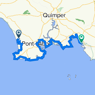
- Plonéour-Lanvern, Brittany Region, France
A cycling route starting in Plonéour-Lanvern, Brittany Region, France.
Overview
Pont l'abbé, Combrit, Tréméoc, Stang ar Bacol, Minven, Menez Kerveyen, Pouldreuzic, Penhors, Plvan, dir Treguennec, le mur bigouden, Stang, Tronoen, Penmarch, dir le Guil, Tréffiagat, Ty Boutic, Pont L'Abbée
created this 10 years ago
Route quality
Road
23.2 km
(33 %)
Quiet road
23.2 km
(33 %)
Paved
38.6 km
(55 %)
Unpaved
1.4 km
(2 %)
Asphalt
38.6 km
(55 %)
Ground
1.4 km
(2 %)
Undefined
30.2 km
(43 %)
Continue with Bikemap
You would like to ride Rando maxi bigoud 1 or customize it for your own trip? Here is what you can do with this Bikemap route:
Free trial for 3 days, or one-time payment. More about Bikemap Premium.
Discover more Premium features.
Get Bikemap PremiumFrom our community
Open it in the app