

Lossburg - Lenzkirch
A cycling route starting in Loßburg, Baden-Wurttemberg, Germany.
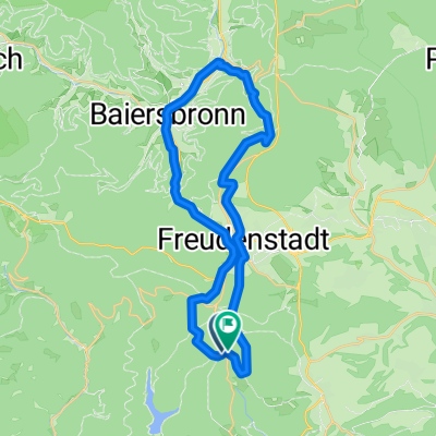
Overview
About this route
The first part of the bike path runs along a forest road downhill to Alpirsbach, a beautiful ride through the woods. Unfortunately, it then continues along a heavily trafficked paved road uphill to the heights of the Black Forest. The following kilometers feature lovely stretches along meadows and fields that are unfortunately repeatedly interrupted by long sections in towns without bike lanes. I had expected much more from the Black Forest region. The Neustadt – Lenzkirch section is pure cycling pleasure.
- -:--
- Duration
- 97.3 km
- Distance
- 914 m
- Ascent
- 739 m
- Descent
- ---
- Avg. speed
- ---
- Max. altitude

Route quality
Waytypes & surfaces along the route
Waytypes
Quiet road
33.1 km
(34 %)
Track
33.1 km
(34 %)
Surfaces
Paved
53.5 km
(55 %)
Unpaved
24.3 km
(25 %)
Asphalt
48.6 km
(50 %)
Gravel
11.7 km
(12 %)
Continue with Bikemap
Use, edit, or download this cycling route
You would like to ride Lossburg - Lenzkirch or customize it for your own trip? Here is what you can do with this Bikemap route:
Free features
- Save this route as favorite or in collections
- Copy & plan your own version of this route
- Split it into stages to create a multi-day tour
- Sync your route with Garmin or Wahoo
Premium features
Free trial for 3 days, or one-time payment. More about Bikemap Premium.
- Navigate this route on iOS & Android
- Export a GPX / KML file of this route
- Create your custom printout (try it for free)
- Download this route for offline navigation
Discover more Premium features.
Get Bikemap PremiumFrom our community
Other popular routes starting in Loßburg
 Loßburgrunde
- Distance
- 74 km
- Ascent
- 723 m
- Descent
- 723 m
- Location
- Loßburg, Baden-Wurttemberg, Germany
 48.420, 8.444 nach 48.344, 8.460
- Distance
- 20.7 km
- Ascent
- 411 m
- Descent
- 488 m
- Location
- Loßburg, Baden-Wurttemberg, Germany
 Wanderung zur Struthütte
- Distance
- 3.8 km
- Ascent
- 147 m
- Descent
- 39 m
- Location
- Loßburg, Baden-Wurttemberg, Germany
 Klosterreichenbach
- Distance
- 32.9 km
- Ascent
- 733 m
- Descent
- 731 m
- Location
- Loßburg, Baden-Wurttemberg, Germany
 Tannen - Stub Loßburg, Großvatertanne, Zwieselberg, Kaltbrunn, Schenkenzell
- Distance
- 33.8 km
- Ascent
- 231 m
- Descent
- 731 m
- Location
- Loßburg, Baden-Wurttemberg, Germany
 E-Bike Tour 4: Von Lossburg rund um den Stausee "Kleine Kinzig"
- Distance
- 29.9 km
- Ascent
- 807 m
- Descent
- 806 m
- Location
- Loßburg, Baden-Wurttemberg, Germany
 RR-Schömberg-Calw-Tamm
- Distance
- 102.9 km
- Ascent
- 760 m
- Descent
- 1,235 m
- Location
- Loßburg, Baden-Wurttemberg, Germany
 Loßburg - Freiburg
- Distance
- 93.3 km
- Ascent
- 598 m
- Descent
- 1,034 m
- Location
- Loßburg, Baden-Wurttemberg, Germany
Open it in the app