
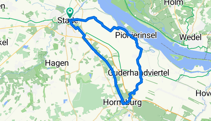

Stade - Winsen
- 63.7 km
- 358 m
- 368 m
- Stade, Lower Saxony, Germany
A cycling route starting in Stade, Lower Saxony, Germany.
Overview
The northern loop of the Fruit Route stretches for 35 kilometers along the Lühe and Elbe rivers through the Altes Land orchard, the largest contiguous fruit-growing area in Germany.
Whether it's an exciting city tour through the Hanseatic city of Stade, culture at Agathenburg Castle, richly decorated Altes Land half-timbered houses along the way, the picturesque Hogendiek Bridge over the Lühe, or the view of the Elbe in Hollern-Twielenfleth – there is plenty to discover on the tour.
created this 11 years ago
Route quality
Track
12.3 km
35 %
Quiet road
7.7 km
22 %
Paved
22.4 km
(64 %)
Unpaved
2.5 km
(7 %)
Asphalt
22.4 km
64 %
Ground
1.8 km
5 %
Continue with Bikemap
You would like to ride Obstroute or customize it for your own trip? Here is what you can do with this Bikemap route:
Free trial for 3 days, or one-time payment. More about Bikemap Premium.
Discover more Premium features.
Get Bikemap PremiumFrom our community
Open it in the app


