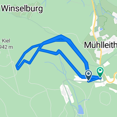
- 14.1 km
- 229 m
- 199 m
- Tannenbergsthal, Saxony, Germany
Höhenmeter sammeln
A cycling route starting in Tannenbergsthal, Saxony, Germany.
Overview
About this route
Collecting elevation meters...
Tannenbergsthal - Mühlleiten - Postillion - Aschberg - Gothestraße - Postillion - Aschberg - Gothestraße - Mittelbergstraße - Auerbacher Str. - Mühlleiten - Tannenbergsthal
- -:--
- Duration
- 39.2 km
- Distance
- 998 m
- Ascent
- 963 m
- Descent
- ---
- Avg. speed
- 879 m
- Max. altitude
Christoph Deike
created this 16 years ago
Route quality
Waytypes & surfaces along the route
Waytypes
Quiet road
7.5 km
(19 %)
Road
7.1 km
(18 %)
Surfaces
Paved
18.8 km
(48 %)
Unpaved
2.7 km
(7 %)
Asphalt
18.8 km
(48 %)
Ground
2.4 km
(6 %)
Continue with Bikemap
Use, edit, or download this cycling route
You would like to ride Höhenmeter sammeln or customize it for your own trip? Here is what you can do with this Bikemap route:
Free features
- Save this route as favorite or in collections
- Copy & plan your own version of this route
- Sync your route with Garmin or Wahoo
Premium features
Free trial for 3 days, or one-time payment. More about Bikemap Premium.
- Navigate this route on iOS & Android
- Export a GPX / KML file of this route
- Create your custom printout (try it for free)
- Download this route for offline navigation
Discover more Premium features.
Get Bikemap PremiumFrom our community
Other popular routes starting in Tannenbergsthal
- uickey 20100109a
- ZP KH Mühlleiten - PERNINK
- 27.1 km
- 393 m
- 419 m
- Tannenbergsthal, Saxony, Germany
- Mühlleithen-Bublava-Brunndöbra-Mühlleithen
- 17.8 km
- 427 m
- 427 m
- Tannenbergsthal, Saxony, Germany
- Uickey 20100123a
- 15.7 km
- 239 m
- 234 m
- Tannenbergsthal, Saxony, Germany
- Vogtlandritt
- 61.8 km
- 787 m
- 925 m
- Tannenbergsthal, Saxony, Germany
- Höhenmeter sammeln
- 39.2 km
- 998 m
- 963 m
- Tannenbergsthal, Saxony, Germany
- Kammtour Erzgebirge Auf dem höchsten Weg durch Sachsen und Böhmen - Kammtour Erzgebirge Auf dem höchsten Weg durch Sachsen und Böhmen
- 233.8 km
- 2,873 m
- 3,132 m
- Tannenbergsthal, Saxony, Germany
- TBT - Klingenthal - TBT
- 25.2 km
- 500 m
- 500 m
- Tannenbergsthal, Saxony, Germany
Open it in the app


