

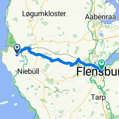
Rudbol - Tönning
A cycling route starting in Neukirchen, Schleswig-Holstein, Germany.
Overview
About this route
The first full day in Germany. In the flatlands, it is easy to follow the signs, although the marking is not always aligned with the NSCR. In the north, with the small villages, it is also pleasant that the route orients from village to village. I would not recommend riding without a map, as there are many variations on how the NSCR is guided. Pleasant cycling in beautiful peaceful nature.
- -:--
- Duration
- 100.8 km
- Distance
- 10 m
- Ascent
- 8 m
- Descent
- ---
- Avg. speed
- ---
- Max. altitude

Route quality
Waytypes & surfaces along the route
Waytypes
Quiet road
37.3 km
(37 %)
Path
31.2 km
(31 %)
Surfaces
Paved
77.6 km
(77 %)
Asphalt
74.6 km
(74 %)
Concrete
2 km
(2 %)
Continue with Bikemap
Use, edit, or download this cycling route
You would like to ride Rudbol - Tönning or customize it for your own trip? Here is what you can do with this Bikemap route:
Free features
- Save this route as favorite or in collections
- Copy & plan your own version of this route
- Split it into stages to create a multi-day tour
- Sync your route with Garmin or Wahoo
Premium features
Free trial for 3 days, or one-time payment. More about Bikemap Premium.
- Navigate this route on iOS & Android
- Export a GPX / KML file of this route
- Create your custom printout (try it for free)
- Download this route for offline navigation
Discover more Premium features.
Get Bikemap PremiumFrom our community
Other popular routes starting in Neukirchen
 2.dagen WD50+
- Distance
- 78.5 km
- Ascent
- 12 m
- Descent
- 12 m
- Location
- Neukirchen, Schleswig-Holstein, Germany
 Kirchenweg 2, Neukirchen nach Kirchenweg 2, Neukirchen
- Distance
- 22.5 km
- Ascent
- 0 m
- Descent
- 0 m
- Location
- Neukirchen, Schleswig-Holstein, Germany
 Neukirchen - Tonder - Südelügum
- Distance
- 23.2 km
- Ascent
- 17 m
- Descent
- 12 m
- Location
- Neukirchen, Schleswig-Holstein, Germany
 DZ - 6+7 - Flensburg
- Distance
- 58.9 km
- Ascent
- 126 m
- Descent
- 115 m
- Location
- Neukirchen, Schleswig-Holstein, Germany
 Rudbol - Tönning
- Distance
- 100.8 km
- Ascent
- 10 m
- Descent
- 8 m
- Location
- Neukirchen, Schleswig-Holstein, Germany
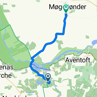 Seebüll, Neukirchen nach Sønderstrengvej, Tønder
- Distance
- 9.8 km
- Ascent
- 9 m
- Descent
- 6 m
- Location
- Neukirchen, Schleswig-Holstein, Germany
 NSCR: Deutsche Etappe
- Distance
- 2,489.6 km
- Ascent
- 151 m
- Descent
- 146 m
- Location
- Neukirchen, Schleswig-Holstein, Germany
 NSCR SH
- Distance
- 217.9 km
- Ascent
- 21 m
- Descent
- 21 m
- Location
- Neukirchen, Schleswig-Holstein, Germany
Open it in the app