

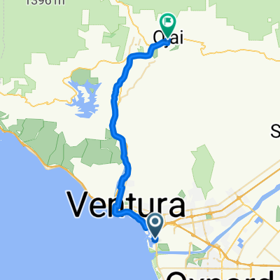
California SR 33 Ventura to Pine Mountain Summit
A cycling route starting in Ventura, California, United States of America.
Overview
About this route
California SR 33 Ventura to Pine Mountain Summit
Bikers rest stop at about 65 km.- -:--
- Duration
- 71.9 km
- Distance
- 1,757 m
- Ascent
- 202 m
- Descent
- ---
- Avg. speed
- ---
- Avg. speed
Route quality
Waytypes & surfaces along the route
Waytypes
Busy road
45.2 km
(63 %)
Cycleway
10.1 km
(14 %)
Surfaces
Paved
10.6 km
(15 %)
Asphalt
10.6 km
(15 %)
Wood
0 km
(<1 %)
Undefined
61.3 km
(85 %)
Continue with Bikemap
Use, edit, or download this cycling route
You would like to ride California SR 33 Ventura to Pine Mountain Summit or customize it for your own trip? Here is what you can do with this Bikemap route:
Free features
- Save this route as favorite or in collections
- Copy & plan your own version of this route
- Sync your route with Garmin or Wahoo
Premium features
Free trial for 3 days, or one-time payment. More about Bikemap Premium.
- Navigate this route on iOS & Android
- Export a GPX / KML file of this route
- Create your custom printout (try it for free)
- Download this route for offline navigation
Discover more Premium features.
Get Bikemap PremiumFrom our community
Other popular routes starting in Ventura
 Ventura to Ojai Bike Trail
- Distance
- 49.9 km
- Ascent
- 352 m
- Descent
- 351 m
- Location
- Ventura, California, United States of America
 Ventura to Ojai
- Distance
- 31.8 km
- Ascent
- 247 m
- Descent
- 24 m
- Location
- Ventura, California, United States of America
 Ventura - Ojai OK
- Distance
- 79.5 km
- Ascent
- 566 m
- Descent
- 557 m
- Location
- Ventura, California, United States of America
 Dealership to Casitas Springs
- Distance
- 49.5 km
- Ascent
- 163 m
- Descent
- 163 m
- Location
- Ventura, California, United States of America
 Vta Rincon
- Distance
- 18.9 km
- Ascent
- 45 m
- Descent
- 50 m
- Location
- Ventura, California, United States of America
 Giro d'Italia Variant 4.etape: Ventura - Alamo Mountain (USA)
- Distance
- 158.7 km
- Ascent
- 2,719 m
- Descent
- 741 m
- Location
- Ventura, California, United States of America
 2827–2855 CA-1, Ventura to 6145 Carpinteria Ave, Carpinteria
- Distance
- 18.5 km
- Ascent
- 3 m
- Descent
- 6 m
- Location
- Ventura, California, United States of America
 casitas
- Distance
- 67.5 km
- Ascent
- 589 m
- Descent
- 581 m
- Location
- Ventura, California, United States of America
Open it in the app