
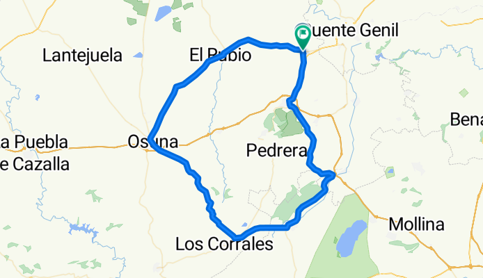
18. HERRERA - ESTEPA – SIERRA YEGUAS – LA JARA – OSUNA – EL RUBIO - HERRERA
A cycling route starting in Herrera, Andalusia, Spain.
Overview
About this route
HERRERA - ESTEPA – SIERRA YEGUAS – <u>LA JARA</u> – OSUNA – EL RUBIO - HERRERA
- -:--
- Duration
- 97.2 km
- Distance
- 703 m
- Ascent
- 700 m
- Descent
- ---
- Avg. speed
- ---
- Max. altitude

Route quality
Waytypes & surfaces along the route
Waytypes
Road
39.5 km
(41 %)
Busy road
39.5 km
(41 %)
Surfaces
Paved
49.3 km
(51 %)
Unpaved
0 km
(<1 %)
Asphalt
34.6 km
(36 %)
Paved (undefined)
14.7 km
(15 %)
Continue with Bikemap
Use, edit, or download this cycling route
You would like to ride 18. HERRERA - ESTEPA – SIERRA YEGUAS – LA JARA – OSUNA – EL RUBIO - HERRERA or customize it for your own trip? Here is what you can do with this Bikemap route:
Free features
- Save this route as favorite or in collections
- Copy & plan your own version of this route
- Split it into stages to create a multi-day tour
- Sync your route with Garmin or Wahoo
Premium features
Free trial for 3 days, or one-time payment. More about Bikemap Premium.
- Navigate this route on iOS & Android
- Export a GPX / KML file of this route
- Create your custom printout (try it for free)
- Download this route for offline navigation
Discover more Premium features.
Get Bikemap PremiumFrom our community
Other popular routes starting in Herrera
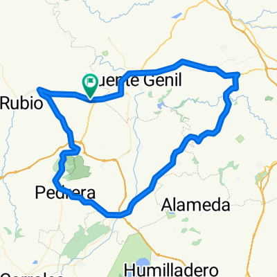 31. Herrera - Ctra Lucena - Las Camilas - Jauja - Badolatosa - La Roda - Pedrera - Gilena - Estepa - Matarredonda - Herrera
- Distance
- 104.1 km
- Ascent
- 858 m
- Descent
- 859 m
- Location
- Herrera, Andalusia, Spain
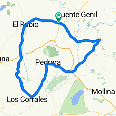
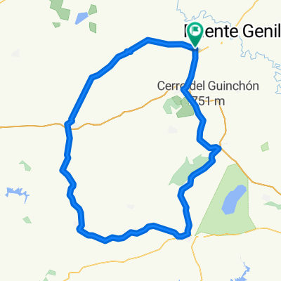 23. Herrera - Estepa - Las Canteras - Campillos - El Saucejo - Osuna - El Rubio - Herrera
- Distance
- 121.4 km
- Ascent
- 768 m
- Descent
- 771 m
- Location
- Herrera, Andalusia, Spain
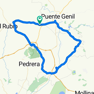 HERRERA - PUENTE GENIL - BADOLATOSA - LA RODA - CANTERAS - ESTEPA - MARINALEDA - HERRERA
- Distance
- 78.9 km
- Ascent
- 683 m
- Descent
- 685 m
- Location
- Herrera, Andalusia, Spain
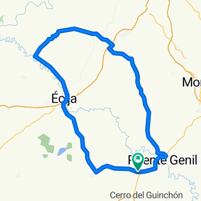 24. Herrera - Puente Genil - Santaella - La Carlota - Fuente Palmera - Ecija - Herrera
- Distance
- 131.2 km
- Ascent
- 674 m
- Descent
- 673 m
- Location
- Herrera, Andalusia, Spain
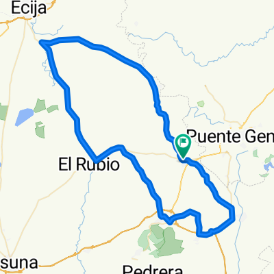
 Herrera - El Rubio - Aguadulce - Ctra El Yesal - La Jara - Pedrera - La Roda - Badolatosa - Casariche - Herrera.
- Distance
- 109.5 km
- Ascent
- 759 m
- Descent
- 758 m
- Location
- Herrera, Andalusia, Spain
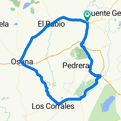 18. HERRERA - ESTEPA – SIERRA YEGUAS – LA JARA – OSUNA – EL RUBIO - HERRERA
- Distance
- 97.2 km
- Ascent
- 703 m
- Descent
- 700 m
- Location
- Herrera, Andalusia, Spain
 7. Herrera - Ctra Isla Redonda - Puente de Gilena - Marinaleda - Mararredonda - Estepa - La Salada - Lora - Casariche - Herrera
- Distance
- 86.9 km
- Ascent
- 581 m
- Descent
- 580 m
- Location
- Herrera, Andalusia, Spain
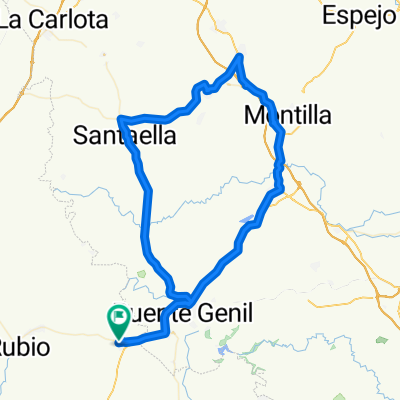 14. HERRERA – AGUILAR – MONTILLA – LA RAMBLA- SANTAELLA - HERRERA
- Distance
- 98 km
- Ascent
- 697 m
- Descent
- 695 m
- Location
- Herrera, Andalusia, Spain
Open it in the app