

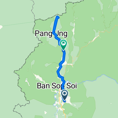
Mae Hong Son,auf der 1095 bis zur Passhöhe.Zurueck bis zum Fischtempel und dann durchs Tal zurueck
A cycling route starting in Mae Hong Son, Mae Hong Son, Thailand.
Overview
About this route
Good roads, a nicer and quieter route through the valley on the way back
- -:--
- Duration
- 67.9 km
- Distance
- 905 m
- Ascent
- 905 m
- Descent
- ---
- Avg. speed
- ---
- Max. altitude
Route quality
Waytypes & surfaces along the route
Waytypes
Road
15.6 km
(23 %)
Quiet road
5.4 km
(8 %)
Surfaces
Paved
62.5 km
(92 %)
Asphalt
62.5 km
(92 %)
Undefined
5.4 km
(8 %)
Continue with Bikemap
Use, edit, or download this cycling route
You would like to ride Mae Hong Son,auf der 1095 bis zur Passhöhe.Zurueck bis zum Fischtempel und dann durchs Tal zurueck or customize it for your own trip? Here is what you can do with this Bikemap route:
Free features
- Save this route as favorite or in collections
- Copy & plan your own version of this route
- Sync your route with Garmin or Wahoo
Premium features
Free trial for 3 days, or one-time payment. More about Bikemap Premium.
- Navigate this route on iOS & Android
- Export a GPX / KML file of this route
- Create your custom printout (try it for free)
- Download this route for offline navigation
Discover more Premium features.
Get Bikemap PremiumFrom our community
Other popular routes starting in Mae Hong Son
 Mae Hong Son,auf der 1095 bis zur Passhöhe.Zurueck bis zum Fischtempel und dann durchs Tal zurueck
- Distance
- 67.9 km
- Ascent
- 905 m
- Descent
- 905 m
- Location
- Mae Hong Son, Mae Hong Son, Thailand
![Thailande 2009 [16/21]: Mae Hong Son - Ban Chan](https://media.bikemap.net/routes/516383/staticmaps/in_abd811d3-9c50-42ce-9f93-76e79b042180_400x400_bikemap-2021-3D-static.png) Thailande 2009 [16/21]: Mae Hong Son - Ban Chan
Thailande 2009 [16/21]: Mae Hong Son - Ban Chan- Distance
- 80.1 km
- Ascent
- 2,796 m
- Descent
- 2,087 m
- Location
- Mae Hong Son, Mae Hong Son, Thailand
 Cycle in Thai 20-2 : Mae Hong Son - Pai
- Distance
- 107.6 km
- Ascent
- 1,933 m
- Descent
- 1,681 m
- Location
- Mae Hong Son, Mae Hong Son, Thailand
 Mae Hong Song - Khun Yuam
- Distance
- 64.5 km
- Ascent
- 872 m
- Descent
- 492 m
- Location
- Mae Hong Son, Mae Hong Son, Thailand
 Mae Hong Son - Mae Aw,und zurueck
- Distance
- 101.4 km
- Ascent
- 1,409 m
- Descent
- 1,377 m
- Location
- Mae Hong Son, Mae Hong Son, Thailand
![Thailande 2009 [15/21]: Mae Hong Son Myanmar Border Tour](https://media.bikemap.net/routes/516379/staticmaps/in_c7965362-e4ca-4cfc-84a4-883eb6677b09_400x400_bikemap-2021-3D-static.png) Thailande 2009 [15/21]: Mae Hong Son Myanmar Border Tour
Thailande 2009 [15/21]: Mae Hong Son Myanmar Border Tour- Distance
- 24.3 km
- Ascent
- 457 m
- Descent
- 351 m
- Location
- Mae Hong Son, Mae Hong Son, Thailand
 Mae Hong Son - Khunyuam 2023
- Distance
- 68.2 km
- Ascent
- 1,488 m
- Descent
- 1,173 m
- Location
- Mae Hong Son, Mae Hong Son, Thailand
 MH Son to Ch M 4 backroads
- Distance
- 221.2 km
- Ascent
- 3,690 m
- Descent
- 3,620 m
- Location
- Mae Hong Son, Mae Hong Son, Thailand
Open it in the app