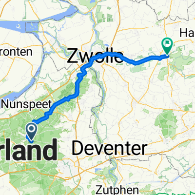
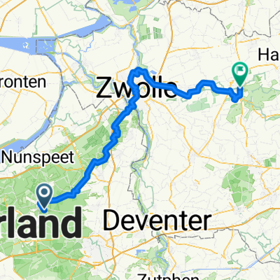
Klimtocht Apeldoorn
A cycling route starting in Uddel, Gelderland, The Netherlands.
Overview
About this route
Een fijn tochtje tussen Uddel en Apeldoorn met 367 hoogtemeters.
- -:--
- Duration
- 58.9 km
- Distance
- 353 m
- Ascent
- 353 m
- Descent
- ---
- Avg. speed
- ---
- Max. altitude
Route quality
Waytypes & surfaces along the route
Waytypes
Cycleway
45.3 km
(77 %)
Road
10 km
(17 %)
Surfaces
Paved
56.5 km
(96 %)
Asphalt
56.5 km
(96 %)
Undefined
2.4 km
(4 %)
Continue with Bikemap
Use, edit, or download this cycling route
You would like to ride Klimtocht Apeldoorn or customize it for your own trip? Here is what you can do with this Bikemap route:
Free features
- Save this route as favorite or in collections
- Copy & plan your own version of this route
- Sync your route with Garmin or Wahoo
Premium features
Free trial for 3 days, or one-time payment. More about Bikemap Premium.
- Navigate this route on iOS & Android
- Export a GPX / KML file of this route
- Create your custom printout (try it for free)
- Download this route for offline navigation
Discover more Premium features.
Get Bikemap PremiumFrom our community
Other popular routes starting in Uddel
- DD 18.
- Distance
- 99.2 km
- Ascent
- 58 m
- Descent
- 106 m
- Location
- Uddel, Gelderland, The Netherlands
- Elspeet - Asseltse Heide -Elspeet
- Distance
- 36 km
- Ascent
- 131 m
- Descent
- 132 m
- Location
- Uddel, Gelderland, The Netherlands
- Klimtocht Apeldoorn
- Distance
- 58.9 km
- Ascent
- 353 m
- Descent
- 353 m
- Location
- Uddel, Gelderland, The Netherlands
- Niederlande Garderen Staverden-Emst
- Distance
- 43.3 km
- Ascent
- 155 m
- Descent
- 153 m
- Location
- Uddel, Gelderland, The Netherlands
- ATB Nunspeet
- Distance
- 34.2 km
- Ascent
- 84 m
- Descent
- 84 m
- Location
- Uddel, Gelderland, The Netherlands
- Elspeet - Asseltse Heide -Elspeet
- Distance
- 39.8 km
- Ascent
- 183 m
- Descent
- 183 m
- Location
- Uddel, Gelderland, The Netherlands
- 03-Uddel-Weesp-76km
- Distance
- 75.4 km
- Ascent
- 127 m
- Descent
- 165 m
- Location
- Uddel, Gelderland, The Netherlands
- Apeldoornseweg naar Voorbrug
- Distance
- 67.7 km
- Ascent
- 182 m
- Descent
- 227 m
- Location
- Uddel, Gelderland, The Netherlands
Open it in the app