Kühren-Postfeld-Pohnsdorf-Preetz-Kühren
A cycling route starting in Kühren, Schleswig-Holstein, Germany.
Overview
About this route
Rundweg, Trainingsstrecke mit leichten Steigungen
- -:--
- Duration
- 18 km
- Distance
- 61 m
- Ascent
- 63 m
- Descent
- ---
- Avg. speed
- ---
- Avg. speed
Route quality
Waytypes & surfaces along the route
Waytypes
Road
8.3 km
(46 %)
Cycleway
5.3 km
(29 %)
Surfaces
Paved
17.8 km
(99 %)
Unpaved
0.1 km
(<1 %)
Asphalt
15.4 km
(85 %)
Concrete
1.3 km
(7 %)
Continue with Bikemap
Use, edit, or download this cycling route
You would like to ride Kühren-Postfeld-Pohnsdorf-Preetz-Kühren or customize it for your own trip? Here is what you can do with this Bikemap route:
Free features
- Save this route as favorite or in collections
- Copy & plan your own version of this route
- Sync your route with Garmin or Wahoo
Premium features
Free trial for 3 days, or one-time payment. More about Bikemap Premium.
- Navigate this route on iOS & Android
- Export a GPX / KML file of this route
- Create your custom printout (try it for free)
- Download this route for offline navigation
Discover more Premium features.
Get Bikemap PremiumFrom our community
Other popular routes starting in Kühren
- Kühren-Postfeld-Pohnsdorf-Preetz-Kühren
- Distance
- 18 km
- Ascent
- 61 m
- Descent
- 63 m
- Location
- Kühren, Schleswig-Holstein, Germany
- Kühren - Honigsee - Rönne - Postfeld - Fischkroog - Kühren
- Distance
- 29 km
- Ascent
- 115 m
- Descent
- 117 m
- Location
- Kühren, Schleswig-Holstein, Germany
- Kühren Preetz Friedhof
- Distance
- 9.6 km
- Ascent
- 97 m
- Descent
- 91 m
- Location
- Kühren, Schleswig-Holstein, Germany
- Preetz nach Hohwacht
- Distance
- 36.2 km
- Ascent
- 155 m
- Descent
- 192 m
- Location
- Kühren, Schleswig-Holstein, Germany
- Kühren - Bogenmanufaktur Stellböken
- Distance
- 16.2 km
- Ascent
- 66 m
- Descent
- 38 m
- Location
- Kühren, Schleswig-Holstein, Germany
- Nabu Aussichtsturm Lanker See
- Distance
- 3.7 km
- Ascent
- 24 m
- Descent
- 25 m
- Location
- Kühren, Schleswig-Holstein, Germany
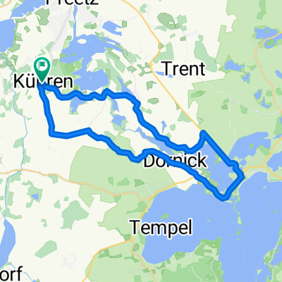
- Kühren-Wittmold-Plön-Dörnick-Kühren
- Distance
- 28.7 km
- Ascent
- 111 m
- Descent
- 111 m
- Location
- Kühren, Schleswig-Holstein, Germany
- Nettelseer Straße nach Nettelseer Straße
- Distance
- 18.2 km
- Ascent
- 78 m
- Descent
- 72 m
- Location
- Kühren, Schleswig-Holstein, Germany
Open it in the app