

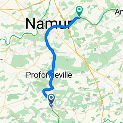
molignée et burnot
A cycling route starting in Yvoir, Wallonia, Belgium.
Overview
About this route
depuis la gare de lustin, jusqu'à celle d'yvoir
- -:--
- Duration
- 51.2 km
- Distance
- 323 m
- Ascent
- 324 m
- Descent
- ---
- Avg. speed
- ---
- Max. altitude

Route quality
Waytypes & surfaces along the route
Waytypes
Cycleway
34.3 km
(67 %)
Road
6.6 km
(13 %)
Surfaces
Paved
20.1 km
(39 %)
Unpaved
0.1 km
(<1 %)
Asphalt
15.8 km
(31 %)
Paved (undefined)
3.5 km
(7 %)
Continue with Bikemap
Use, edit, or download this cycling route
You would like to ride molignée et burnot or customize it for your own trip? Here is what you can do with this Bikemap route:
Free features
- Save this route as favorite or in collections
- Copy & plan your own version of this route
- Sync your route with Garmin or Wahoo
Premium features
Free trial for 3 days, or one-time payment. More about Bikemap Premium.
- Navigate this route on iOS & Android
- Export a GPX / KML file of this route
- Create your custom printout (try it for free)
- Download this route for offline navigation
Discover more Premium features.
Get Bikemap PremiumFrom our community
Other popular routes starting in Yvoir
 Yvoir
Yvoir- Distance
- 33.9 km
- Ascent
- 742 m
- Descent
- 742 m
- Location
- Yvoir, Wallonia, Belgium
 EuroVelo 19 - La Meuse à Vélo - Tronçon Belgique
- Distance
- 26.2 km
- Ascent
- 280 m
- Descent
- 295 m
- Location
- Yvoir, Wallonia, Belgium
 crupet
- Distance
- 18.2 km
- Ascent
- 458 m
- Descent
- 468 m
- Location
- Yvoir, Wallonia, Belgium
 molignée et burnot
- Distance
- 51.2 km
- Ascent
- 323 m
- Descent
- 324 m
- Location
- Yvoir, Wallonia, Belgium
 soulme 2
- Distance
- 55.4 km
- Ascent
- 443 m
- Descent
- 436 m
- Location
- Yvoir, Wallonia, Belgium
 Traversée des 4 Vallées
- Distance
- 49.7 km
- Ascent
- 1,368 m
- Descent
- 1,369 m
- Location
- Yvoir, Wallonia, Belgium
 UCY_Sortie_04_06_avril_2014_garmin
- Distance
- 63.9 km
- Ascent
- 420 m
- Descent
- 422 m
- Location
- Yvoir, Wallonia, Belgium
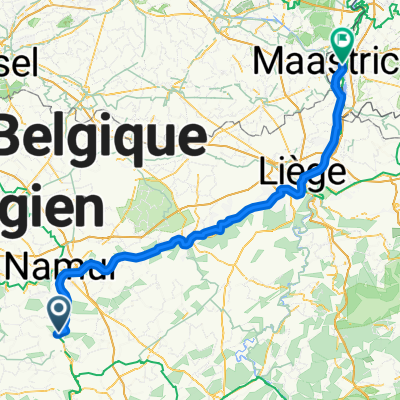 Rue des Villas, Yvoir nach Grote Staat, Maastricht
- Distance
- 114.6 km
- Ascent
- 600 m
- Descent
- 630 m
- Location
- Yvoir, Wallonia, Belgium
Open it in the app