
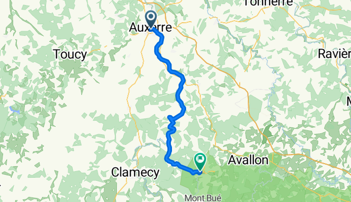
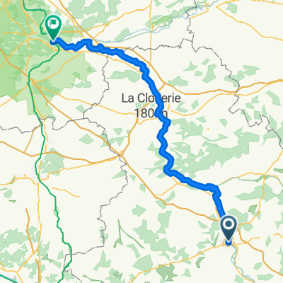
Camino 2015 10 Auxerre nach Vezelay
A cycling route starting in Auxerre, Bourgogne-Franche-Comté, France.
Overview
About this route
from km 42 to km 51, increasingly steep ascent (130 hm)from km 53 to km 55, 40 hm ascentthen a steep descentbefore Vézelay, another uphillHotel Le Compostelle1 Place du Champ de Foire,89450 Vézelay,Tel:+33 3 86 33 28 63
- -:--
- Duration
- 58.3 km
- Distance
- 299 m
- Ascent
- 168 m
- Descent
- ---
- Avg. speed
- ---
- Max. altitude

Route quality
Waytypes & surfaces along the route
Waytypes
Cycleway
19.8 km
(34 %)
Quiet road
7.6 km
(13 %)
Surfaces
Paved
42.6 km
(73 %)
Unpaved
0.6 km
(1 %)
Asphalt
41.4 km
(71 %)
Paved (undefined)
1.2 km
(2 %)
Continue with Bikemap
Use, edit, or download this cycling route
You would like to ride Camino 2015 10 Auxerre nach Vezelay or customize it for your own trip? Here is what you can do with this Bikemap route:
Free features
- Save this route as favorite or in collections
- Copy & plan your own version of this route
- Sync your route with Garmin or Wahoo
Premium features
Free trial for 3 days, or one-time payment. More about Bikemap Premium.
- Navigate this route on iOS & Android
- Export a GPX / KML file of this route
- Create your custom printout (try it for free)
- Download this route for offline navigation
Discover more Premium features.
Get Bikemap PremiumFrom our community
Other popular routes starting in Auxerre
 Bourgogne Loire Seine Yonne
- Distance
- 715.3 km
- Ascent
- 1,893 m
- Descent
- 1,893 m
- Location
- Auxerre, Bourgogne-Franche-Comté, France
 From Sens to Samoreau
- Distance
- 129.4 km
- Ascent
- 250 m
- Descent
- 307 m
- Location
- Auxerre, Bourgogne-Franche-Comté, France
 Burgund - Auxerre - Yonne - Canal de Nivernais
- Distance
- 49.7 km
- Ascent
- 389 m
- Descent
- 348 m
- Location
- Auxerre, Bourgogne-Franche-Comté, France
 Route to Commelle-Vernay
- Distance
- 404 km
- Ascent
- 1,446 m
- Descent
- 1,445 m
- Location
- Auxerre, Bourgogne-Franche-Comté, France
 Quai de la Marine, Auxerre to rest. du canal ,Migennes
- Distance
- 25.4 km
- Ascent
- 40 m
- Descent
- 58 m
- Location
- Auxerre, Bourgogne-Franche-Comté, France
 Girolibero: Il Canale di Borgogna e del Nivernais
- Distance
- 257.3 km
- Ascent
- 1,120 m
- Descent
- 995 m
- Location
- Auxerre, Bourgogne-Franche-Comté, France
 Camino 2015 10 Auxerre nach Vezelay
- Distance
- 58.3 km
- Ascent
- 299 m
- Descent
- 168 m
- Location
- Auxerre, Bourgogne-Franche-Comté, France
 Parcours n° 1
- Distance
- 54.7 km
- Ascent
- 381 m
- Descent
- 380 m
- Location
- Auxerre, Bourgogne-Franche-Comté, France
Open it in the app