D1W2 Ustrzyki Dolne - Otryt
A cycling route starting in Ustrzyki Dolne, Subcarpathian Voivodeship, Poland.
Overview
About this route
DzieÅ„ pierwszy, Wariant 2Â
Wejście na połoninę Wetlińską Nocleg na Otrycie- -:--
- Duration
- 70.2 km
- Distance
- 2,032 m
- Ascent
- 1,670 m
- Descent
- ---
- Avg. speed
- ---
- Max. altitude
Route quality
Waytypes & surfaces along the route
Waytypes
Track
36.4 km
(52 %)
Path
14.5 km
(21 %)
Surfaces
Paved
24.7 km
(35 %)
Unpaved
33.7 km
(48 %)
Ground
18.7 km
(27 %)
Asphalt
16 km
(23 %)
Continue with Bikemap
Use, edit, or download this cycling route
You would like to ride D1W2 Ustrzyki Dolne - Otryt or customize it for your own trip? Here is what you can do with this Bikemap route:
Free features
- Save this route as favorite or in collections
- Copy & plan your own version of this route
- Sync your route with Garmin or Wahoo
Premium features
Free trial for 3 days, or one-time payment. More about Bikemap Premium.
- Navigate this route on iOS & Android
- Export a GPX / KML file of this route
- Create your custom printout (try it for free)
- Download this route for offline navigation
Discover more Premium features.
Get Bikemap PremiumFrom our community
Other popular routes starting in Ustrzyki Dolne
- Duża Pętla Bieszczadzka
- Distance
- 142.7 km
- Ascent
- 1,120 m
- Descent
- 1,120 m
- Location
- Ustrzyki Dolne, Subcarpathian Voivodeship, Poland
- Bieszczady 2015
- Distance
- 211 km
- Ascent
- 2,749 m
- Descent
- 2,764 m
- Location
- Ustrzyki Dolne, Subcarpathian Voivodeship, Poland
- Monday trip 🙂
- Distance
- 34.8 km
- Ascent
- 276 m
- Descent
- 273 m
- Location
- Ustrzyki Dolne, Subcarpathian Voivodeship, Poland
- Muddy trip 🙂
- Distance
- 32.7 km
- Ascent
- 537 m
- Descent
- 538 m
- Location
- Ustrzyki Dolne, Subcarpathian Voivodeship, Poland
- Rowerowe wakacje 2014 - alternatywna trasa
- Distance
- 1,344.6 km
- Ascent
- 1,337 m
- Descent
- 1,689 m
- Location
- Ustrzyki Dolne, Subcarpathian Voivodeship, Poland
- Ustrzyki Dolne - Strzyżów
- Distance
- 117.7 km
- Ascent
- 1,371 m
- Descent
- 1,580 m
- Location
- Ustrzyki Dolne, Subcarpathian Voivodeship, Poland
- Solina Lake loop 🙂
- Distance
- 77.6 km
- Ascent
- 1,157 m
- Descent
- 1,156 m
- Location
- Ustrzyki Dolne, Subcarpathian Voivodeship, Poland
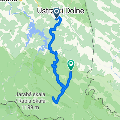
- Polskiego Czerwonego Krzyża 52, Ustrzyki Dolne do Solina 176, Solina
- Distance
- 16.3 km
- Ascent
- 686 m
- Descent
- 745 m
- Location
- Ustrzyki Dolne, Subcarpathian Voivodeship, Poland
Open it in the app