

Stromsholm - Balsta
A cycling route starting in Kolbäck, Västmanland County, Sweden.
Overview
About this route
Last day of the three day-tour. Balsta is also the start point for the tour up to north in 2012. Balsta is the most remote station for SL pendeltag (train) to Stockholm. You might find a very good overview of all bicycle routes in Sweden in „Skyltade Cykelleder i Sverige“ However be aware that Cycle lanes in Sweden runs primarily on (main) roads.
Done: 2011 - 06 -13- -:--
- Duration
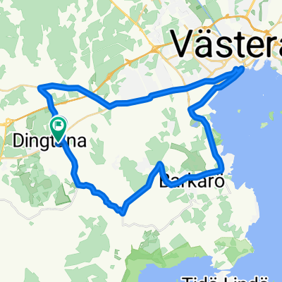
- 112.1 km
- Distance
- 239 m
- Ascent
- 235 m
- Descent
- ---
- Avg. speed
- ---
- Max. altitude

Route quality
Waytypes & surfaces along the route
Waytypes
Road
70.7 km
(63 %)
Cycleway
22.1 km
(20 %)
Surfaces
Paved
86.1 km
(77 %)
Unpaved
3.8 km
(3 %)
Asphalt
81.3 km
(73 %)
Paved (undefined)
4.7 km
(4 %)
Continue with Bikemap
Use, edit, or download this cycling route
You would like to ride Stromsholm - Balsta or customize it for your own trip? Here is what you can do with this Bikemap route:
Free features
- Save this route as favorite or in collections
- Copy & plan your own version of this route
- Split it into stages to create a multi-day tour
- Sync your route with Garmin or Wahoo
Premium features
Free trial for 3 days, or one-time payment. More about Bikemap Premium.
- Navigate this route on iOS & Android
- Export a GPX / KML file of this route
- Create your custom printout (try it for free)
- Download this route for offline navigation
Discover more Premium features.
Get Bikemap PremiumFrom our community
Other popular routes starting in Kolbäck
 Tingshusgatan 21 to Tingshusgatan 21
- Distance
- 75.4 km
- Ascent
- 413 m
- Descent
- 416 m
- Location
- Kolbäck, Västmanland County, Sweden
 Oskarsborgsvägen 37, Strömsholm to Oskarsborgsvägen 37, Strömsholm
- Distance
- 11.9 km
- Ascent
- 135 m
- Descent
- 133 m
- Location
- Kolbäck, Västmanland County, Sweden
 Stromsholm - Balsta
- Distance
- 112.1 km
- Ascent
- 239 m
- Descent
- 235 m
- Location
- Kolbäck, Västmanland County, Sweden
 UTNÄS 11 to Valskogsvägen 70
- Distance
- 29.9 km
- Ascent
- 139 m
- Descent
- 139 m
- Location
- Kolbäck, Västmanland County, Sweden
 Strömsholm-Dufweholm
- Distance
- 95.7 km
- Ascent
- 474 m
- Descent
- 433 m
- Location
- Kolbäck, Västmanland County, Sweden
 Albertusvägen, Västerås to Albertusvägen, Västerås
- Distance
- 32 km
- Ascent
- 104 m
- Descent
- 108 m
- Location
- Kolbäck, Västmanland County, Sweden
 ECT2020 Mälaren norra
- Distance
- 145.5 km
- Ascent
- 240 m
- Descent
- 241 m
- Location
- Kolbäck, Västmanland County, Sweden
 Kolbäck-Julita
- Distance
- 66 km
- Ascent
- 201 m
- Descent
- 186 m
- Location
- Kolbäck, Västmanland County, Sweden
Open it in the app