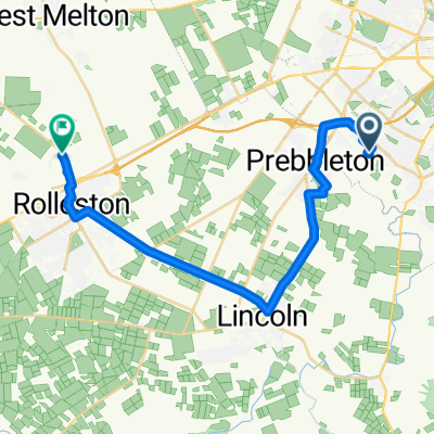
288A Kennedys Bush Road, Kennedys Bush to 7 Kapuka Lane, Kennedys Bush
- 39.9 km
- 636 m
- 643 m
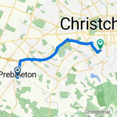
- Prebbleton, Canterbury, New Zealand
After several years of promotion by a working party comprising the Department of Conservation (DOC), Environment Canterbury, the Christchurch City Council, Selwyn District Council, Banks Peninsula District Council, Transit New Zealand and others, a group of enthusiastic supporters came together in November 2003 as the Christchurch to Little River Rail Trail Trust to develop the cycleway/walkway from Christchurch to Little River.
The Christchurch to Little River Rail Trail mostly follows the route of a 19th century railway line between Hornby Junction and Little River via Prebbleton, Lincoln, Motukarara and Birdlings Flat until its closure in 1962. The rail corridor from Motukarara to Little River has remained in public ownership, but has been little used by the public, because creeks and rivers are not bridged along the route of the trail itself. It is managed on behalf of the public by the Department of Conservation. The railway embankment is in sound condition.
The first major rail trail to be formed in New Zealand was the Otago Central Rail Trail. This 150 km route winds through some very remote areas between Clyde and Middlemarch. Originally, the concept was strongly opposed by local farmers whose land adjoined the route, but now some of these farmers are its strongest supporters. Local communities are benefiting from the 30,000-plus visitors per annum who walk and cycle the rail trail. Local farmers have set up accommodation facilities. Shops and transport operators have also greatly benefited from the establishment of the rail trail. Hostels and farm stays have increased in number and some hotels have reopened.
Cycleway
34.3 km69 %Quiet road
8 km16 %Paved
22.9 km(46 %)Unpaved
26.8 km(54 %)Gravel
20.9 km42 %Asphalt
11.9 km24 %Free trial for 3 days, or one-time payment. More about Bikemap Premium.
Discover more Premium features.
Get Bikemap PremiumOpen it in the app