

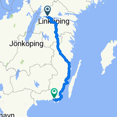
Borensberg -Wald 16 MAI 2013
A cycling route starting in Borensberg, Östergötland County, Sweden.
Overview
About this route
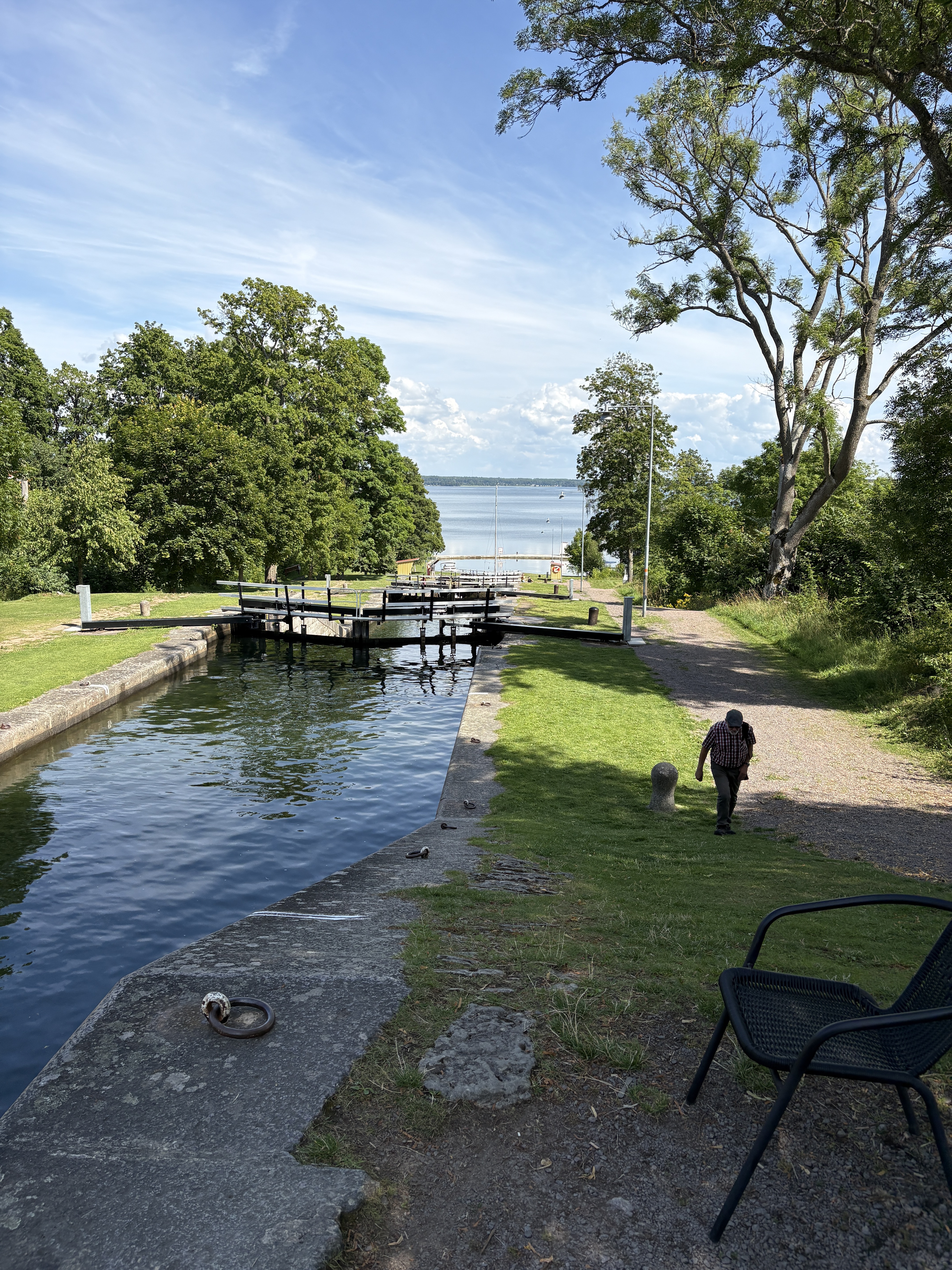
In the morning still along the Göta Canal to Berg at the lock steps. From here to Linköping. Leaving the city, the route always went south until it became necessary to find a place to camp. That was near the road on a tiny clearing in the forest.
- -:--
- Duration
- 106.6 km
- Distance
- 247 m
- Ascent
- 224 m
- Descent
- ---
- Avg. speed
- ---
- Max. altitude
Route quality
Waytypes & surfaces along the route
Waytypes
Road
42.6 km
(40 %)
Path
18.1 km
(17 %)
Surfaces
Paved
67.1 km
(63 %)
Unpaved
32 km
(30 %)
Asphalt
67.1 km
(63 %)
Gravel
20.2 km
(19 %)
Continue with Bikemap
Use, edit, or download this cycling route
You would like to ride Borensberg -Wald 16 MAI 2013 or customize it for your own trip? Here is what you can do with this Bikemap route:
Free features
- Save this route as favorite or in collections
- Copy & plan your own version of this route
- Split it into stages to create a multi-day tour
- Sync your route with Garmin or Wahoo
Premium features
Free trial for 3 days, or one-time payment. More about Bikemap Premium.
- Navigate this route on iOS & Android
- Export a GPX / KML file of this route
- Create your custom printout (try it for free)
- Download this route for offline navigation
Discover more Premium features.
Get Bikemap PremiumFrom our community
Other popular routes starting in Borensberg
 Strandbadens campingområde, Borensberg nach Hamnpiren, Motala
- Distance
- 19.6 km
- Ascent
- 114 m
- Descent
- 101 m
- Location
- Borensberg, Östergötland County, Sweden
 Borensberg-Tjällmo-Ljungsbro-Borensberg
- Distance
- 71.1 km
- Ascent
- 445 m
- Descent
- 442 m
- Location
- Borensberg, Östergötland County, Sweden
 Linköping-Göteborg
- Distance
- 651.6 km
- Ascent
- 544 m
- Descent
- 552 m
- Location
- Borensberg, Östergötland County, Sweden
 atkarpa Gote Kanal iki ezero
- Distance
- 22 km
- Ascent
- 138 m
- Descent
- 151 m
- Location
- Borensberg, Östergötland County, Sweden
 Borensberg to, Motala
- Distance
- 19.8 km
- Ascent
- 157 m
- Descent
- 134 m
- Location
- Borensberg, Östergötland County, Sweden
 Borensberg -Wald 16 MAI 2013
- Distance
- 106.6 km
- Ascent
- 247 m
- Descent
- 224 m
- Location
- Borensberg, Östergötland County, Sweden
 Borensberg - Karlskronar
- Distance
- 400.1 km
- Ascent
- 369 m
- Descent
- 444 m
- Location
- Borensberg, Östergötland County, Sweden
 Borensberg-Gränna
- Distance
- 87.9 km
- Ascent
- 254 m
- Descent
- 210 m
- Location
- Borensberg, Östergötland County, Sweden
Open it in the app