

Sankt Wendeler Land 1
A cycling route starting in Marpingen, Saarland, Germany.
Overview
About this route
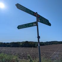
We begin our tour at the forest parking lot at Rheinstraße and set off towards Habenichts. Via Remmesweiler and Oberlinxweiler, the route leads us to St. Wendel, where we switch to the decommissioned railway line converted into a bike path towards Tholey. In Oberthal, we leave the bike path and follow the signage towards Bostalsee. After circling the lake, we head to Neunkirchen Nahe and from there on marked paths through Selbach and the Johann Adams Mill to Theley. After a short stretch on public roads through Theley and then towards Tholey, we leave the main road to the left and follow the signs to the Wareswald archaeological site. After another short ascent, we turn right into the forest and follow the Römerstraße back towards Rheinstraße.
- -:--
- Duration
- 48.6 km
- Distance
- 475 m
- Ascent
- 497 m
- Descent
- ---
- Avg. speed
- 464 m
- Max. altitude
Route quality
Waytypes & surfaces along the route
Waytypes
Quiet road
13.1 km
(27 %)
Track
13.1 km
(27 %)
Surfaces
Paved
34.5 km
(71 %)
Unpaved
9.2 km
(19 %)
Asphalt
27.2 km
(56 %)
Paved (undefined)
7.3 km
(15 %)
Continue with Bikemap
Use, edit, or download this cycling route
You would like to ride Sankt Wendeler Land 1 or customize it for your own trip? Here is what you can do with this Bikemap route:
Free features
- Save this route as favorite or in collections
- Copy & plan your own version of this route
- Sync your route with Garmin or Wahoo
Premium features
Free trial for 3 days, or one-time payment. More about Bikemap Premium.
- Navigate this route on iOS & Android
- Export a GPX / KML file of this route
- Create your custom printout (try it for free)
- Download this route for offline navigation
Discover more Premium features.
Get Bikemap PremiumFrom our community
Other popular routes starting in Marpingen
 Rundweg Marpinger Land
- Distance
- 16.7 km
- Ascent
- 251 m
- Descent
- 251 m
- Location
- Marpingen, Saarland, Germany
 Am Langenstrank nach Am Langenstrank
- Distance
- 38.9 km
- Ascent
- 560 m
- Descent
- 604 m
- Location
- Marpingen, Saarland, Germany
 Wünschberg Tour
- Distance
- 41.7 km
- Ascent
- 533 m
- Descent
- 533 m
- Location
- Marpingen, Saarland, Germany
 Marpingen - Skulpturenstraße - Bostalsee
- Distance
- 54.7 km
- Ascent
- 602 m
- Descent
- 617 m
- Location
- Marpingen, Saarland, Germany
 MTB 5 Sankt Wendeler Land
- Distance
- 21.1 km
- Ascent
- 339 m
- Descent
- 339 m
- Location
- Marpingen, Saarland, Germany
 Am Langenstrank nach Am Langenstrank
- Distance
- 35.6 km
- Ascent
- 406 m
- Descent
- 460 m
- Location
- Marpingen, Saarland, Germany
 Römeretappe
- Distance
- 47.1 km
- Ascent
- 620 m
- Descent
- 623 m
- Location
- Marpingen, Saarland, Germany
 MTB 5 Sankt Wendeler Land
- Distance
- 21.1 km
- Ascent
- 350 m
- Descent
- 350 m
- Location
- Marpingen, Saarland, Germany
Open it in the app