

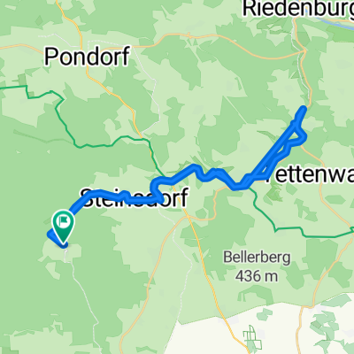
Kasing - Audi TE 24km Rennrad
A cycling route starting in Oberdolling, Bavaria, Germany.
Overview
About this route
Way to Audi with detours on asphalt
- -:--
- Duration
- 24.3 km
- Distance
- 104 m
- Ascent
- 132 m
- Descent
- ---
- Avg. speed
- ---
- Max. altitude
Route quality
Waytypes & surfaces along the route
Waytypes
Quiet road
10 km
(41 %)
Path
8.3 km
(34 %)
Surfaces
Paved
22.1 km
(91 %)
Unpaved
0.7 km
(3 %)
Asphalt
21.7 km
(89 %)
Gravel
0.7 km
(3 %)
Continue with Bikemap
Use, edit, or download this cycling route
You would like to ride Kasing - Audi TE 24km Rennrad or customize it for your own trip? Here is what you can do with this Bikemap route:
Free features
- Save this route as favorite or in collections
- Copy & plan your own version of this route
- Sync your route with Garmin or Wahoo
Premium features
Free trial for 3 days, or one-time payment. More about Bikemap Premium.
- Navigate this route on iOS & Android
- Export a GPX / KML file of this route
- Create your custom printout (try it for free)
- Download this route for offline navigation
Discover more Premium features.
Get Bikemap PremiumFrom our community
Other popular routes starting in Oberdolling
 30.05.2025
- Distance
- 14.9 km
- Ascent
- 261 m
- Descent
- 275 m
- Location
- Oberdolling, Bavaria, Germany
 Köschinger Forst
- Distance
- 26.5 km
- Ascent
- 204 m
- Descent
- 204 m
- Location
- Oberdolling, Bavaria, Germany
 Oberdolling, Oberdolling nach Lorenzistraße, Oberdolling
- Distance
- 73.4 km
- Ascent
- 747 m
- Descent
- 739 m
- Location
- Oberdolling, Bavaria, Germany
 Tour 2 Bettbr.-Hexenagger
- Distance
- 32.8 km
- Ascent
- 169 m
- Descent
- 191 m
- Location
- Oberdolling, Bavaria, Germany
 Siedlerstraße 6, Oberdolling nach Siedlerstraße 6, Oberdolling
- Distance
- 88.1 km
- Ascent
- 1,749 m
- Descent
- 1,748 m
- Location
- Oberdolling, Bavaria, Germany
 Buchenstraße 3A, Großmehring nach Straße ohne Straßennamen, Pfaffenhofen an der Ilm
- Distance
- 44.6 km
- Ascent
- 226 m
- Descent
- 143 m
- Location
- Oberdolling, Bavaria, Germany
 bettbrunn-köschinger Forsthaus
- Distance
- 8.5 km
- Ascent
- 93 m
- Descent
- 77 m
- Location
- Oberdolling, Bavaria, Germany
 Kasing - Audi TE 24km Rennrad
- Distance
- 24.3 km
- Ascent
- 104 m
- Descent
- 132 m
- Location
- Oberdolling, Bavaria, Germany
Open it in the app