

13 francia
A cycling route starting in La Roche-des-Arnauds, Provence-Alpes-Côte d'Azur Region, France.
Overview
About this route
Col du Festre (1448 m)Col du Noyer (1664 m)Col de l'Holme (1208 m)Col de Parquetout (1382 m)Col d'Ornon (1373 m)
- -:--
- Duration
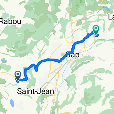
- 111 km
- Distance
- 2,299 m
- Ascent
- 2,524 m
- Descent
- ---
- Avg. speed
- ---
- Max. altitude

Route quality
Waytypes & surfaces along the route
Waytypes
Road
42.2 km
(38 %)
Quiet road
7.8 km
(7 %)
Surfaces
Paved
25.5 km
(23 %)
Unpaved
2.2 km
(2 %)
Asphalt
25.5 km
(23 %)
Ground
2.2 km
(2 %)
Undefined
83.3 km
(75 %)
Route highlights
Points of interest along the route
Point of interest after 13.3 km
Col du Festre (1448 m)
Point of interest after 32.7 km
Col du Noyer (1664 m)
Point of interest after 66.8 km
Col de l'Holme (1208 m)
Point of interest after 72.3 km
Col de Parquetout (1382 m)
Point of interest after 96.4 km
Col d'Ornon (1373 m)
Continue with Bikemap
Use, edit, or download this cycling route
You would like to ride 13 francia or customize it for your own trip? Here is what you can do with this Bikemap route:
Free features
- Save this route as favorite or in collections
- Copy & plan your own version of this route
- Split it into stages to create a multi-day tour
- Sync your route with Garmin or Wahoo
Premium features
Free trial for 3 days, or one-time payment. More about Bikemap Premium.
- Navigate this route on iOS & Android
- Export a GPX / KML file of this route
- Create your custom printout (try it for free)
- Download this route for offline navigation
Discover more Premium features.
Get Bikemap PremiumFrom our community
Other popular routes starting in La Roche-des-Arnauds
Fenix3 Hr®
La Roche-des-Arnauds Cycling- Distance
- 12.9 km
- Ascent
- 124 m
- Descent
- 256 m
- Location
- La Roche-des-Arnauds, Provence-Alpes-Côte d'Azur Region, France
 Pelleautier - Prats Hauts
- Distance
- 100.4 km
- Ascent
- 2,553 m
- Descent
- 1,812 m
- Location
- La Roche-des-Arnauds, Provence-Alpes-Côte d'Azur Region, France
 Côte de Correo
- Distance
- 4 km
- Ascent
- 234 m
- Descent
- 0 m
- Location
- La Roche-des-Arnauds, Provence-Alpes-Côte d'Azur Region, France
 Puget-Théniers - Station de Céüse
- Distance
- 233 km
- Ascent
- 2,667 m
- Descent
- 3,979 m
- Location
- La Roche-des-Arnauds, Provence-Alpes-Côte d'Azur Region, France
 ceuse-gap-ceuse
- Distance
- 50.5 km
- Ascent
- 559 m
- Descent
- 849 m
- Location
- La Roche-des-Arnauds, Provence-Alpes-Côte d'Azur Region, France
 2015 Montmaur-Barcelonnette
- Distance
- 86.1 km
- Ascent
- 837 m
- Descent
- 651 m
- Location
- La Roche-des-Arnauds, Provence-Alpes-Côte d'Azur Region, France
 Traversée la Rama par l’Aiglière et Rocher Rond
- Distance
- 12.4 km
- Ascent
- 1,284 m
- Descent
- 1,284 m
- Location
- La Roche-des-Arnauds, Provence-Alpes-Côte d'Azur Region, France
 Senas par Sault
- Distance
- 188.6 km
- Ascent
- 1,283 m
- Descent
- 2,221 m
- Location
- La Roche-des-Arnauds, Provence-Alpes-Côte d'Azur Region, France
Open it in the app