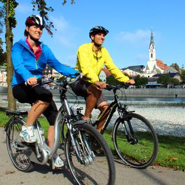
Rundfahrt zw. Isar und Loisach ab Bad Heilbrunn
A cycling route starting in Bad Heilbrunn, Bavaria, Germany.
Overview
About this route
In Bad Heilbrunn we start at the parish church of St.Kilian and cycle through Bad Heilbrunn past the tourist information and the specialist clinic towards Ramsau. In Ramsau we continue right up to Oberbuchen, which is distinguished by its beautifully situated church on a hill. Here you can choose to go straight along the short flat path directly to Unterbuchen or keep right and cycle uphill a bit via Linden and Spiegel to Unterbuchen. From Unterbuchen, we head to Schwaighofen. At Schönrain, we cross the B11 and reach Nantesbuch with a steady up and down and cycle towards the Loisach. Here we keep left towards the south and reach Hohenbirken, Unterkarpfsee and Mürrnsee. In the district of Reindlschmiede, we go through idyllic meadows of Ramsau back to Bad Heilbrunn.
- -:--
- Duration
- 35 km
- Distance
- 251 m
- Ascent
- 228 m
- Descent
- ---
- Avg. speed
- ---
- Max. altitude
Route quality
Waytypes & surfaces along the route
Waytypes
Quiet road
20.3 km
(58 %)
Track
5.9 km
(17 %)
Surfaces
Paved
21.3 km
(61 %)
Unpaved
3.8 km
(11 %)
Asphalt
21.3 km
(61 %)
Gravel
3.8 km
(11 %)
Undefined
9.8 km
(28 %)
Continue with Bikemap
Use, edit, or download this cycling route
You would like to ride Rundfahrt zw. Isar und Loisach ab Bad Heilbrunn or customize it for your own trip? Here is what you can do with this Bikemap route:
Free features
- Save this route as favorite or in collections
- Copy & plan your own version of this route
- Sync your route with Garmin or Wahoo
Premium features
Free trial for 3 days, or one-time payment. More about Bikemap Premium.
- Navigate this route on iOS & Android
- Export a GPX / KML file of this route
- Create your custom printout (try it for free)
- Download this route for offline navigation
Discover more Premium features.
Get Bikemap PremiumFrom our community
Other popular routes starting in Bad Heilbrunn
 AKB 04
- Distance
- 63 km
- Ascent
- 538 m
- Descent
- 528 m
- Location
- Bad Heilbrunn, Bavaria, Germany
 Bad Heilbrunn Wieskirche
- Distance
- 52.9 km
- Ascent
- 547 m
- Descent
- 359 m
- Location
- Bad Heilbrunn, Bavaria, Germany
 Bad Heilbrunn - Tegernsee - Bad Heilbrunn
- Distance
- 72 km
- Ascent
- 901 m
- Descent
- 901 m
- Location
- Bad Heilbrunn, Bavaria, Germany
 Bad Heilbrunn-Fischbachau
- Distance
- 53.2 km
- Ascent
- 485 m
- Descent
- 397 m
- Location
- Bad Heilbrunn, Bavaria, Germany
 Zwiesel-Trail
- Distance
- 12.8 km
- Ascent
- 698 m
- Descent
- 698 m
- Location
- Bad Heilbrunn, Bavaria, Germany
 Bad Tölz - Walchensee - Vorderriß
- Distance
- 64.7 km
- Ascent
- 396 m
- Descent
- 333 m
- Location
- Bad Heilbrunn, Bavaria, Germany
 Bo - Kö 04 Bad Heilbrunn - Fischbachau
- Distance
- 64.1 km
- Ascent
- 610 m
- Descent
- 483 m
- Location
- Bad Heilbrunn, Bavaria, Germany
 Rundfahrt zw. Isar und Loisach ab Bad Heilbrunn
- Distance
- 35 km
- Ascent
- 251 m
- Descent
- 228 m
- Location
- Bad Heilbrunn, Bavaria, Germany
Open it in the app


