

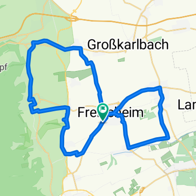
Freinsheim - Kurpfalzpark
A cycling route starting in Freinsheim, Rhineland-Palatinate, Germany.
Overview
About this route
Training für Kraftausdauer. Ab Wachenheim stetige Steigung aber nicht zu steil.
- -:--
- Duration
- 18.4 km
- Distance
- 231 m
- Ascent
- 54 m
- Descent
- ---
- Avg. speed
- 299 m
- Max. altitude
Route quality
Waytypes & surfaces along the route
Waytypes
Road
7.4 km
(40 %)
Busy road
7.2 km
(39 %)
Surfaces
Paved
17.9 km
(98 %)
Unpaved
0.1 km
(<1 %)
Asphalt
17.4 km
(95 %)
Paving stones
0.3 km
(2 %)
Continue with Bikemap
Use, edit, or download this cycling route
You would like to ride Freinsheim - Kurpfalzpark or customize it for your own trip? Here is what you can do with this Bikemap route:
Free features
- Save this route as favorite or in collections
- Copy & plan your own version of this route
- Sync your route with Garmin or Wahoo
Premium features
Free trial for 3 days, or one-time payment. More about Bikemap Premium.
- Navigate this route on iOS & Android
- Export a GPX / KML file of this route
- Create your custom printout (try it for free)
- Download this route for offline navigation
Discover more Premium features.
Get Bikemap PremiumFrom our community
Other popular routes starting in Freinsheim
 Pfalztour Tag 1
- Distance
- 25.7 km
- Ascent
- 564 m
- Descent
- 500 m
- Location
- Freinsheim, Rhineland-Palatinate, Germany
 Südpfalztour. Recht einfach, außer der Länge.
- Distance
- 140.1 km
- Ascent
- 332 m
- Descent
- 333 m
- Location
- Freinsheim, Rhineland-Palatinate, Germany
 Rund um den Drachenfels
- Distance
- 65.4 km
- Ascent
- 503 m
- Descent
- 534 m
- Location
- Freinsheim, Rhineland-Palatinate, Germany
 Kleine Runde
- Distance
- 31.4 km
- Ascent
- 221 m
- Descent
- 193 m
- Location
- Freinsheim, Rhineland-Palatinate, Germany
 Weinstraßenradrundweg durch die Urlaubsregion Freinsheim
- Distance
- 22.9 km
- Ascent
- 253 m
- Descent
- 253 m
- Location
- Freinsheim, Rhineland-Palatinate, Germany
 Weinstraßenradrundweg durch die Urlaubsregion Freinsheim - Weinstraßenradrundweg durch die Urlaubsregion Freinsheim
- Distance
- 22.7 km
- Ascent
- 260 m
- Descent
- 261 m
- Location
- Freinsheim, Rhineland-Palatinate, Germany
 Oschelskopftour Deutsche Weinstraße
- Distance
- 31.5 km
- Ascent
- 281 m
- Descent
- 283 m
- Location
- Freinsheim, Rhineland-Palatinate, Germany
 Freinsheim - Kurpfalzpark
- Distance
- 18.4 km
- Ascent
- 231 m
- Descent
- 54 m
- Location
- Freinsheim, Rhineland-Palatinate, Germany
Open it in the app